Pizzo di Claro, Mountain summit in Grisons and Ticino, Switzerland
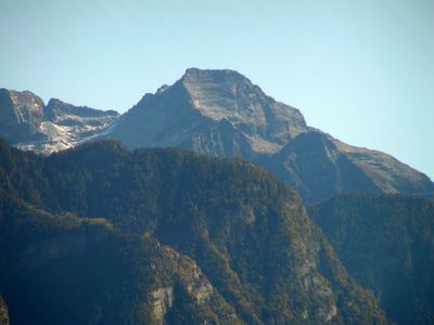
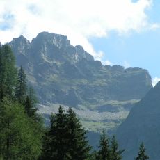
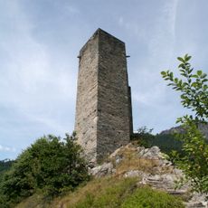
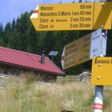
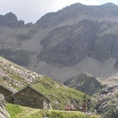
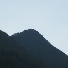
Pizzo di Claro is a mountain peak reaching 2,727 meters that forms the boundary between the cantons of Ticino and Graubünden. Multiple trails ascend from different valleys and villages, with the Capanna Brogoldone hut at 1,910 meters providing shelter for those making the climb.
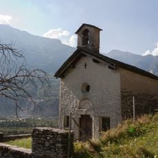
The mountain served as a border marker and navigation point for ancient communities in the region. Over time, footpaths developed connecting settlements on both sides, facilitating trade and communication across the terrain.
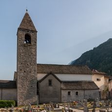
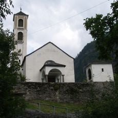
The mountain holds deep roots in the lives of nearby communities, who view the summit as a landmark defining their regional identity. Local tradition ties people to the mountain through personal milestones and connection to the landscape.
The best climbing season runs from June to September when trails are free from snow and stable. Sturdy footwear and water are essential, as the ascent involves demanding terrain and some exposed sections.
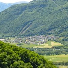
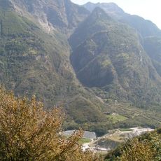
The mountain rises steeply from the Leventina valley with a vertical gain exceeding 2,500 meters, creating one of the region's most dramatic ascents. This exceptional relief has inspired an annual trail running race that draws athletes from far and wide.
Location: Grisons
Location: Ticino
Elevation above the sea: 2,727 m
GPS coordinates: 46.29604,9.05562
Latest update: December 14, 2025 14:24
Sbarramento Lodrino-Osogna
7.5 km
Torent Alto
5.4 km
Church of St. Mary of the Assumption and parish house (old convent)
7.9 km
Sta. Maria Castle
7.9 km
Pala Castle
7.3 km
Church and Monastery of St. Mary of the Assumption
4.6 km
Scuola elementare Castaneda
7.8 km
Osservatorio Astronomico di Gnosca
7.3 km
Rifugio Domàs
2.6 km
Pizzo Magn
8.1 km
Pizzo di Campedell
3.2 km
Chiesa cattolica di SS Giovanni e Vittore
7.6 km
Chiesa dei Santi Carpoforo e Maurizio
8.2 km
San Vittore Parish Church
5.6 km
Santi Felino e Gratiniano Parish Church
5.6 km
Santi Simone e Giuda Parish Church
5.5 km
Parish Church of San Ambrogio in Lodrino
6 km
Church of San Martino
6.7 km
Chiesa della Madonna della Cintola
5.5 km
Parochial church of Santi Martiri Maccabei
7.8 km
Cima di Visghéd
7.7 km
Chiesa di San Lorenzo
4.5 km
Church of Santa Maria del Castello
5.5 km
Church of the Santa Pietà
4.8 km
Ruderi della chiesa di San Giovanni Battista
7.7 km
Brücke und Umgebung, Arvigo
4.6 km
Cappella Madonna di Loreto, Cauco
6.3 km
Cappella di San Lucio
7.4 kmVisited this place? Tap the stars to rate it and share your experience / photos with the community! Try now! You can cancel it anytime.
Discover hidden gems everywhere you go!
From secret cafés to breathtaking viewpoints, skip the crowded tourist spots and find places that match your style. Our app makes it easy with voice search, smart filtering, route optimization, and insider tips from travelers worldwide. Download now for the complete mobile experience.
A unique approach to discovering new places❞
— Le Figaro
All the places worth exploring❞
— France Info
A tailor-made excursion in just a few clicks❞
— 20 Minutes