Gitschen, Mountain summit in Uri, Switzerland
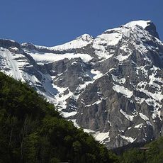
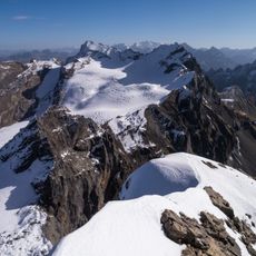
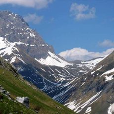
Gitschen is a summit in the Urner Alps rising to 2513 meters. The mountain is defined by steep rock faces and varied terrain that changes character across its different approaches.
The Gitschen appears on sheet 1191 (Engelberg) of the Swiss national map at 1:25,000, the cartographic record of the ridge it belongs to. Its documented setting is the range north of the Surenen Pass, on a north-east running spur of the Uri Rotstock together with the Rot Gitschen. Two mountain paths reach the ridge south of the summit, one from the Chlital in the Isenthal from the north-west and one from the west, joining there for the last stretch to the highest point.
The name Gitschen also belongs to the Gitschital valley southeast of the massif and to Alp Gitschenberg below the east-side rock wall, reached from Seedorf by cable car. The two climbing paths start in the Chlital valley in Isenthal, one from the northwest and one from the west.
The route demands mountaineering experience and proper gear since it crosses steep terrain and rock sections. Summer offers the best climbing window when snow retreats and weather conditions are more stable.
The Gitschen rises only about 70 metres above the lowest point of its ridge, yet it stands more than 2,000 metres above the Reuss plain near Seedorf. Two trails climb from the Chlital in the Isenthal valley, partly on exposed ground, and join on the ridge south of the summit. The Alp Gitschenberg below its east face is reached by cable car from Seedorf.
The community of curious travelers
AroundUs brings together thousands of curated places, local tips, and hidden gems, enriched daily by 94,623 contributors worldwide.