Piz Bles, Alpine summit in Grisons, Switzerland
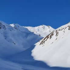
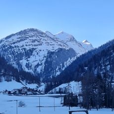
Piz Bles is a 3044 m mountain in the Oberhalbstein Alps, on the border between Bregaglia in Graubünden, Switzerland, and Piuro in Sondrio, Italy. The Val Madris, a side valley of the Averstal, bounds it to the east and the Valle di Lei to the west, where the Lago di Lei reservoir lies. Three ridges leave the summit: a rocky east ridge with several sub-summits, a north ridge that is blocky above and turns to scree below, and a south ridge that drops only slightly.
The summit lies on the border between the municipalities of Bregaglia (Graubünden, Switzerland) and Piuro (Sondrio, Italy), a line that follows the ridge of the Oberhalbstein Alps. The peak belongs to the Schiahorn–Pizz Gallagiun chain, and the border runs directly over the summit. The surrounding valleys, Val Madris and Valle di Lei, are named in the sources as the two flanks of the mountain.
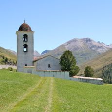
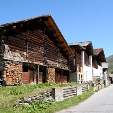
The name Piz Bles comes from the Romansh language, reflecting the cultural identity of Graubünden canton. The surrounding valleys still show signs of traditional Alpine life, with old grazing lands and pathways that connect remote communities.
Routes to the summit start from Stettli (Cröt, 1800 m) in Val Madris or from the Lago di Lei dam (1933 m). The north ridge via Pass de la Bles (2788 m) is rated L and takes about 4¼ hours from Stettli or 5¾ hours from the dam. The east ridge and the southeast approach are not recommended because the rock has become brittle since the glaciers retreated.
The farthest point visible from Piz Bles is Testa Nord di Bresses (2,830 m) in Valdieri, Piedmont, Italy, 302 km away and just 370 m from the French border. Small glaciers, more like two firn fields, remain at the foot of the north flank and in the niche between the east and south ridges.
The community of curious travelers
AroundUs brings together thousands of curated places, local tips, and hidden gems, enriched daily by 93,721 contributors worldwide.