Höch Turm, Mountain summit in the Schwyzer Alps, Muotathal, Switzerland
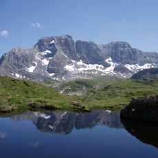
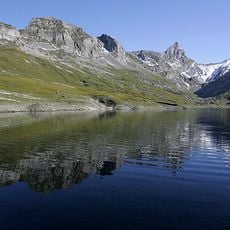
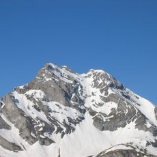
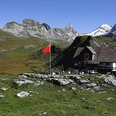
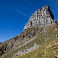
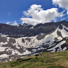
Höch Turm is a 2,666 m mountain in the Schwyzer Alps, the highest point of the ridge separating the Glattalp with the Glattalpsee (1,853 m) from the Charetalp. It lies in the municipality of Muotathal, canton Schwyz, about 1 km northwest of the 2,717 m Ortstock; the 2,395 m Furggele pass connects the two. The summit is reached by an alpine T6 route over the west ridge from the Glattalphütte (1,896 m).
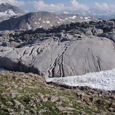
The sources record no medieval boundary role for the Höch Turm. The mountain lies in the municipality of Muotathal in the canton of Schwyz, on the karstic range between the Muota and Linth valleys, west of Braunwald. Its documented geography is the chain separating the Glattalp with the Glattalpsee at 1,853 m from the Charetalp, with the Furggele pass at 2,395 m linking the Glattalp to the Linth valley.
The name Höch Turm means "high tower" in Swiss German, fitting a summit that rises above the Glattalp. The peak stands on the karstic ridge between the Muota and Linth valleys, and the pass Furggele at 2,395 m below it links the Glattalp with the Linth valley, a route walkers cross on the way between the two sides.
Plan your visit during the climbing season when the mountain shelter is open and can provide support. Expect alpine conditions and bring proper mountain boots along with safety gear for the terrain.
The Höch Turm is the highest point of the karst ridge that separates the Glattalp with its lake at 1,853 m from the Charetalp. The next higher summit, the Ortstock at 2,717 m, lies about 1 km to the southeast, separated from the Höch Turm by the Furggele pass at 2,395 m, which links the Glattalp with the Linth valley.
The community of curious travelers
AroundUs brings together thousands of curated places, local tips, and hidden gems, enriched daily by 93,873 contributors worldwide.