Igl Compass, Mountain summit in Albula Region, Switzerland
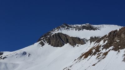
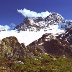
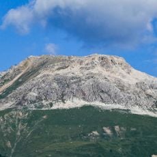
Igl Compass is a 3016 meter peak in the Albula Region marked by dark Lias slate formations. Multiple routes approach this summit from different valleys and starting points.
This peak has long served as a boundary marker between two municipalities, with the border running 87 meters east of the summit. This geographical role established it as a known reference point in the regional landscape.
The name comes from Romansh language, where 'Igl' means 'the' as spoken in this valley community. Local people recognize this peak as a landmark within their mountain landscape.
Hikers approach this summit along several routes that meet at a mountain pass before the final climb. The western approach is rated as difficulty level T2 and needs standard hiking boots.
The dark slate of this mountain contains fossilized belemnites and ammonites from ancient seas. These embedded shells show that this area was once underwater.
The community of curious travelers
AroundUs brings together thousands of curated places, local tips, and hidden gems, enriched daily by 60,000 contributors worldwide.