Enable Location

We need your location to show you interesting places around you

Discover nearby places

Find interesting locations and hidden gems around you

Precise directions

Get accurate directions and distances to places

Your location is never shared with other users. It's only used when you tap the location button.

Georgenfelder Hochmoor

Log in to your account

Start exploring — it's free

Trusted by 61,909 travelers worldwide

Continue with Google
Continue with Apple
or

We will send you a code to connect

By continuing, you accept our Terms and Conditions and our Privacy Policy

Check your inbox

We've sent a pincode in your inbox. Please enter the code below.

Georgenfelder Hochmoor

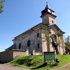
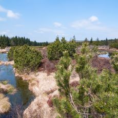
Georgenfelder Hochmoor, Nature reserve in Altenberg, Germany

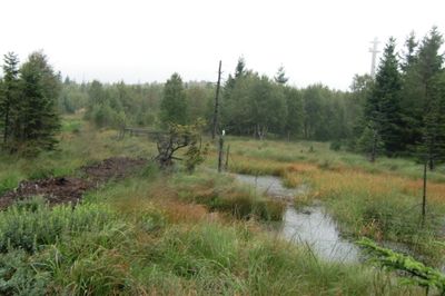
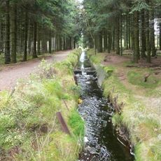
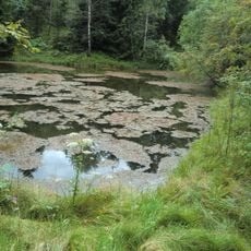
Georgenfelder Hochmoor is a nature reserve in the Ore Mountains featuring boardwalks that guide visitors across peat bogs and wet depressions. The raised walkways allow you to explore the landscape while protecting the delicate ground beneath your feet.

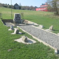
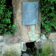
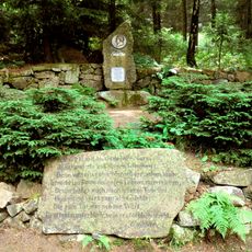
The bog formed after the Elster glaciation when melting ice left behind small lakes where peat accumulated over thousands of years. Protection efforts began in the early 1900s and the site became officially designated as a protected nature reserve in 1961.

The State Association for Saxon Conservation initiated protection efforts in the early 20th century, leading to the establishment of this nature reserve in 1961.

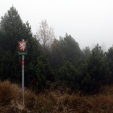
You can access the site using marked hiking trails on your own or join a guided visit for more detailed information. Wear sturdy footwear and check the weather beforehand, as the open moorland offers little protection from wind and rain.

The bog contains thick peat deposits that support specialized plants like cranberry and bog bilberry found nowhere else in the region. These species thrive only in this specific wet and cold environment and have become increasingly rare elsewhere.

The community of curious travelers

AroundUs brings together thousands of curated places, local tips, and hidden gems, enriched daily by 60,000 contributors worldwide.

Start exploring
Location
Inception
1961
GPS coordinates
50.73004,13.74639
Latest update
December 12, 2025 14:20
Around this place
Kahleberg
Germany

Kahleberg

2.3 km
Jagdschloss Rehefeld
Germany

Jagdschloss Rehefeld

3.1 km
Rašeliniště U jezera - Cínovecké rašeliniště
Czech Republic

Rašeliniště U jezera - Cínovecké rašeliniště

346 m
Church of the Assumption of the Virgin Mary in Cínovec
Czech Republic

Church of the Assumption of the Virgin Mary in Cínovec

2.1 km
Hraniční buk
Czech Republic

Hraniční buk

1.6 km
Quergraben
Germany

Quergraben

3.4 km
Římskokatolická farnost Cínovec
Czech Republic

Římskokatolická farnost Cínovec

2.1 km
Pomníky lidických žen a amerických letců u hraničního přechodu v Cínovci
Czech Republic

Pomníky lidických žen a amerických letců u hraničního přechodu v Cínovci

1.6 km
Pomník osvobození na hřbitově v Cínovci
Czech Republic

Pomník osvobození na hřbitově v Cínovci

2.2 km
Socha Krista u zdi kostela v Cínovci
Czech Republic

Socha Krista u zdi kostela v Cínovci

2.1 km
Pomník první zmínky o Cínovci
Czech Republic

Pomník první zmínky o Cínovci

1.4 km
Rašeliniště U jezera - Cínovecké rašeliniště
Czech Republic

Rašeliniště U jezera - Cínovecké rašeliniště

1.9 km
Pomník padlým ochráncům československých státních hranic v Cínovci
Czech Republic

Pomník padlým ochráncům československých státních hranic v Cínovci

1.7 km
Pomník padlých v Cínovci
Czech Republic

Pomník padlých v Cínovci

2.2 km
Arno-Lippmann-Schacht („Bergbaumonumente Altenberg“) Zinnwalder Straße 5
Germany

Arno-Lippmann-Schacht („Bergbaumonumente Altenberg“) Zinnwalder Straße 5

3.5 km
Kříž u rozcestí k golfišti v Cínovci
Czech Republic

Kříž u rozcestí k golfišti v Cínovci

1.1 km
Waldschänke Altes Raupennest Raupennestweg 4
Germany

Waldschänke Altes Raupennest Raupennestweg 4

3.3 km
Kříž u kostela v Cínovci
Czech Republic

Kříž u kostela v Cínovci

2.1 km
Kříž u cesty k Husově vrchu v Cínovci
Czech Republic

Kříž u cesty k Husově vrchu v Cínovci

2 km
Anton-Günther-Denkmal Zinnwalder Straße
Germany

Anton-Günther-Denkmal Zinnwalder Straße

2.7 km
Kříž u cesty za hotelem Lípa v Cínovci
Czech Republic

Kříž u cesty za hotelem Lípa v Cínovci

1.3 km
Hotel „Berghof Raupennest“ („Sanatorium Raupennest“) Zinnwalder Straße 38
Germany

Hotel „Berghof Raupennest“ („Sanatorium Raupennest“) Zinnwalder Straße 38

3.3 km
Georgenfelder Hochmoor
Germany

Georgenfelder Hochmoor

197 m
Schwarzer Teich („Bergbaumonumente Altenberg“)
Germany

Schwarzer Teich („Bergbaumonumente Altenberg“)

3.1 km
Quergraben („Bergbaumonumente Altenberg“)
Germany

Quergraben („Bergbaumonumente Altenberg“)

2.9 km
Gedenkstein Aschergrabenweg
Germany

Gedenkstein Aschergrabenweg

3.4 km
Brautstock Langegassenweg
Germany

Brautstock Langegassenweg

2.8 km
Kříž na rozcestí u cesty ke kostelu
Czech Republic

Kříž na rozcestí u cesty ke kostelu

1.7 km
Show the full map
« Georgenfelder Hochmoor - Nature reserve in Altenberg, Germany » is provided by Around Us (aroundus.com). Images and texts are derived from Wikimedia project under a Creative Commons license. You are allowed to copy, distribute, and modify copies of this page, under the conditions set by the license, as long as this note is clearly visible.

Discover hidden gems everywhere you go!

From secret cafés to breathtaking viewpoints, skip the crowded tourist spots and find places that match your style. Our app makes it easy with voice search, smart filtering, route optimization, and insider tips from travelers worldwide. Download now for the complete mobile experience.

Around Us App Screenshot

A unique approach to discovering new places

Le Figaro

All the places worth exploring

France Info

A tailor-made excursion in just a few clicks

20 Minutes

Around Us
Travel Guide & Maps
Download

Send to your phone

QR Code
1

Open the camera app on your mobile.

2

Point at the QR code with your camera. A notification will appear.

3

Tap the notification to open the link.