Chest opened
+${chestReward.xp} XP
Explorer
NOUVEAU ×${chestReward.collectible.quantity}
tapez pour fermer
Chest locked

Open chests in the app

Around Us is built for your phone — chests unlock when you walk, explore and capture nearby places.

Enable Location

We need your location to show you interesting places around you

Discover nearby places

Find interesting locations and hidden gems around you

Precise directions

Get accurate directions and distances to places

Your location is never shared with other users. It's only used when you tap the location button.

Frisian Islands

Log in to your account

Start exploring — it's free

Trusted by 72,919 travelers worldwide

Continue with Google
Continue with Apple
or

We will send you a code to connect

By continuing, you accept our Terms and Conditions and our Privacy Policy

Check your inbox

We've sent a pincode in your inbox. Please enter the code below.

Frisian Islands
Discussion Reviews 1 Photos
119k Popularity

Frisian Islands, Chain of islands in Lower Saxony and Schleswig-Holstein, Germany.

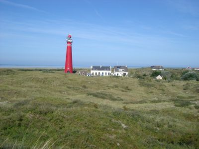
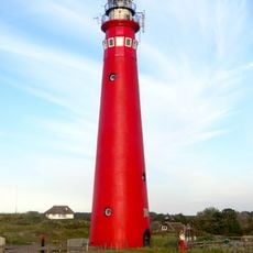
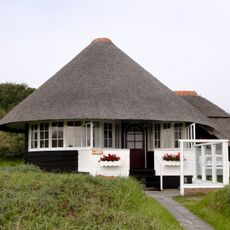
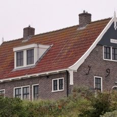
The Frisian Islands are a chain of islands stretching along Germany's northern coast in Lower Saxony and Schleswig-Holstein, forming a natural barrier between the North Sea and the Wadden Sea. The islands span roughly 90 kilometers from Borkum in the west to Sylt in the north, each featuring its own dune landscapes and beaches.

Archaeological finds document settlements dating back to the Iron Age, when inhabitants built artificial mounds known as terps to protect against storm surges. During the medieval period, the islands developed into important bases for sailors and fishermen who helped shape North Sea trade from here.

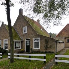
On the inhabited islands, many residents still wear elements of traditional dress for festivals, while local celebrations feature old sea shanties and special baked goods like egg cakes. Each island follows its own tea-drinking customs, which involve specific rituals with multiple servings and small pastries.

Ferries operate year-round from the mainland to all inhabited islands, with crossings taking between one and three hours depending on the tide. During summer months, additional water taxis and smaller boats provide flexible connections between closer islands.

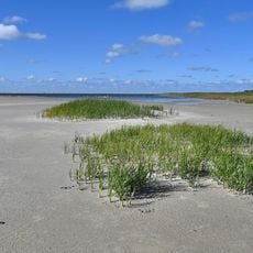
The daily tides expose vast sand flats twice a day, allowing visitors to walk between some islands at low tide. Guided mudflat walks are necessary, as the water can return quickly and unexpectedly.

The community of curious travelers

AroundUs brings together thousands of curated places, local tips, and hidden gems, enriched daily by 60,000 contributors worldwide.

Start exploring
Location
Elevation above the sea
4 m
GPS coordinates
53.95000,8.50000
Latest update
December 12, 2025 22:22
Around this place
North Tower
Netherlands

North Tower

163.4 km
Got Tjark
Netherlands

Got Tjark

162.8 km
Sint-Egbertuskapel
Netherlands

Sint-Egbertuskapel

162.8 km
Opduin
Netherlands

Opduin

162.9 km
Badweg 43, Schiermonnikoog
Netherlands

Badweg 43, Schiermonnikoog

162.7 km
Dunes of Schiermonnikoog
Netherlands

Dunes of Schiermonnikoog

162.5 km
Schelpenmuseum Paal 14
Netherlands

Schelpenmuseum Paal 14

163.3 km
De Horst
Netherlands

De Horst

163.2 km
Anagber
Netherlands

Anagber

163 km
Westerstrand
Netherlands

Westerstrand

164.5 km
Langestreek 130, Schiermonnikoog
Netherlands

Langestreek 130, Schiermonnikoog

163 km
Middenstreek 33, Schiermonnikoog
Netherlands

Middenstreek 33, Schiermonnikoog

163 km
Langestreek 52, Schiermonnikoog
Netherlands

Langestreek 52, Schiermonnikoog

162.6 km
Langestreek 54, Schiermonnikoog
Netherlands

Langestreek 54, Schiermonnikoog

162.6 km
Langestreek 60, Schiermonnikoog
Netherlands

Langestreek 60, Schiermonnikoog

162.7 km
Middenstreek 24, Schiermonnikoog
Netherlands

Middenstreek 24, Schiermonnikoog

162.9 km
Pandje met zesruitsvensters onder zadeldak tegen topgevel met beitelingen en topvenster terzijde van het rookkanaal
Netherlands

Pandje met zesruitsvensters onder zadeldak tegen topgevel met beitelingen en topvenster terzijde van het rookkanaal

163.2 km
Middenstreek 66, Schiermonnikoog
Netherlands

Middenstreek 66, Schiermonnikoog

163.1 km
Middenstreek 60, Schiermonnikoog
Netherlands

Middenstreek 60, Schiermonnikoog

163.1 km
Pand met gecementeerde gevel, zesruitsvensters en houten goot op blokken onder aan de voorzijde afgewolfd zadeldak
Netherlands

Pand met gecementeerde gevel, zesruitsvensters en houten goot op blokken onder aan de voorzijde afgewolfd zadeldak

162.9 km
Pand met zesruitsvensters en houten goot op blokjes onder aan de voorzijde afgewolfd zadeldak
Netherlands

Pand met zesruitsvensters en houten goot op blokjes onder aan de voorzijde afgewolfd zadeldak

163.1 km
Pand met zesruitsvensters en houten goot op blokjes onder aan de voorzijde afgewolfd zadeldak
Netherlands

Pand met zesruitsvensters en houten goot op blokjes onder aan de voorzijde afgewolfd zadeldak

163 km
Pand met zesruitsvensters en houten goot op blokjes onder aan de voorzijde afgewolfd zadeldak
Netherlands

Pand met zesruitsvensters en houten goot op blokjes onder aan de voorzijde afgewolfd zadeldak

163 km
Pand onder zadeldak tussen topgevels met vernieuwde achtergevel
Netherlands

Pand onder zadeldak tussen topgevels met vernieuwde achtergevel

163 km
Langestreek 72, Schiermonnikoog
Netherlands

Langestreek 72, Schiermonnikoog

162.7 km
Langestreek 58, Schiermonnikoog
Netherlands

Langestreek 58, Schiermonnikoog

162.6 km
Pand met zesruitsvensters onder zadeldak tegen gewitte puntgevel met topvenster terzijde van het rookkanaal
Netherlands

Pand met zesruitsvensters onder zadeldak tegen gewitte puntgevel met topvenster terzijde van het rookkanaal

162.9 km
Monument in de N.H. kerk
Netherlands

Monument in de N.H. kerk

162.7 km
Show the full map
Reviews
Share your experience

No review yet

Discussions
Start a discussion...

No discussion yet

« Frisian Islands - Chain of islands in Lower Saxony and Schleswig-Holstein, Germany » is provided by Around Us (aroundus.com). Images and texts are derived from Wikimedia project under a Creative Commons license. You are allowed to copy, distribute, and modify copies of this page, under the conditions set by the license, as long as this note is clearly visible.

Discover hidden gems everywhere you go!

From secret cafés to breathtaking viewpoints, skip the crowded tourist spots and find places that match your style. Our app makes it easy with voice search, smart filtering, route optimization, and insider tips from travelers worldwide. Download now for the complete mobile experience.

Around Us App Screenshot

A unique approach to discovering new places

Le Figaro

All the places worth exploring

France Info

A tailor-made excursion in just a few clicks

20 Minutes

Around Us
Travel Guide & Maps
Download

Send to your phone

QR Code
1

Open the camera app on your mobile.

2

Point at the QR code with your camera. A notification will appear.

3

Tap the notification to open the link.