Blomberg, Urban municipality in Lippe, Germany
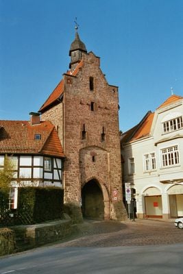
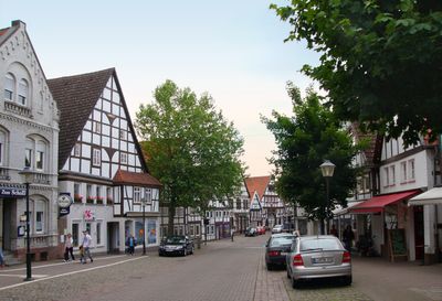
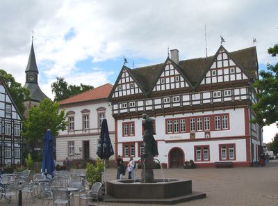
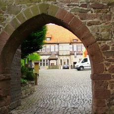
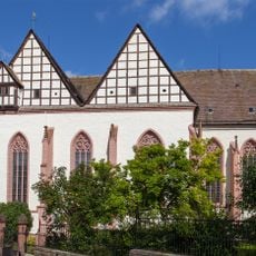
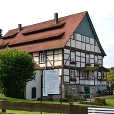
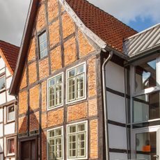
Blomberg is an urban municipality in the Lippe region featuring a well-preserved town center with timber-framed and stone buildings. The area is surrounded by medieval fortification walls and gates that date back to the 13th century.
The settlement was founded between 1231 and 1255 by Count Bernhard III at the intersection of three major medieval trade routes in the Lippe region. This strategic location allowed it to grow as a commercial center over the following centuries.
The weekly market happens every Friday on the central square, maintaining a long-standing connection between local farmers and residents. Vendors set up their stalls following traditions that have shaped daily life here for centuries.
The town has direct bus connections to nearby cities, with regular services to Detmold to the west. Visitors can easily walk through the old town since the fortifications and historic streets are laid out close together.
The town underwent a major transformation in 1970 when seventeen independent municipalities merged into a single administrative unit. This consolidation doubled the population and fundamentally reshaped the region.
Location: Lippe
Elevation above the sea: 185 m
Shares border with: Schieder-Schwalenberg, Lügde, Detmold, Horn-Bad Meinberg, Barntrup, Dörentrup, Lemgo
Phone: +4952355040
Website: https://blomberg-lippe.de
GPS coordinates: 51.93306,9.08306
Latest update: December 14, 2025 18:37
Schiedersee
5.8 km
Burg Blomberg
1.1 km
Schloss Schieder
5.1 km
Herlingsburg
7.4 km
Wasserschloss Reelkirchen
4.1 km
Kahlenbergturm
6.5 km
Klosterkirche
1.3 km
Papiermühle Plöger
4.9 km
Marpetal mit Passade und Zuflüsse
6.8 km
Schwalenberger Wald
5.8 km
Alt-Schieder
6 km
Evangelisch-reformierte Kirche Cappel
6.4 km
Evangelische Kirche Sonneborn
10.4 kmDomäne Schieder
5 km
Evangelische Kirche Bega
8.2 km
Nieseniederung mit Mündungsbereich
4.8 km
St. Martin (Blomberg)
1.4 km
Rathaus Blomberg
1.3 kmJüdischer Friedhof
1.8 km
Hurn
3 km
Evangelische Kirche Reelkirchen
4.3 km
Evangelische Kirche Donop
8.6 km
Evangelische Kirche Barntrup
6.7 km
Talsystem des Königsbaches
2.7 kmJüdischer Friedhof
7 km
Synagoge (Blomberg)
1.1 kmJüdischer Friedhof
6.3 kmJüdischer Friedhof (Reelkirchen)
4.4 kmVisited this place? Tap the stars to rate it and share your experience / photos with the community! Try now! You can cancel it anytime.
Discover hidden gems everywhere you go!
From secret cafés to breathtaking viewpoints, skip the crowded tourist spots and find places that match your style. Our app makes it easy with voice search, smart filtering, route optimization, and insider tips from travelers worldwide. Download now for the complete mobile experience.
A unique approach to discovering new places❞
— Le Figaro
All the places worth exploring❞
— France Info
A tailor-made excursion in just a few clicks❞
— 20 Minutes