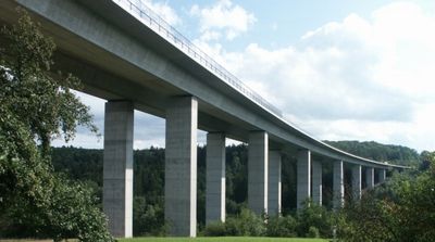
Aichtalbrücke, Road bridge in Aichtal, Germany.
The Aichtalbrücke is a four-lane concrete bridge that crosses two valleys and forms part of a major transport route. It uses multiple beam structures arranged side by side to span the geography, with its substantial height visible from considerable distances.
Construction of this bridge began in the late 1970s and was completed in the early 1980s to create a connection between two major cities. The project marked a significant step forward for regional infrastructure and joined two important transport corridors.
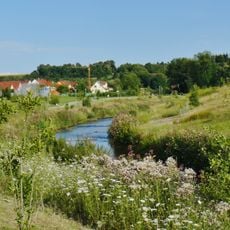
The bridge forms part of numerous cycling routes in Baden-Württemberg, connecting local communities and providing access to regional recreational paths.
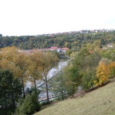
The bridge is easily reached from both sides of the valley and offers viewing points from the valley floor. Visitors can observe the structure from different angles and explore it from the surrounding elevated areas.
The bridge was built using a special construction technique where large concrete sections were gradually shifted across the valleys. This method was world-leading at the time of completion and set standards for similar large-scale projects.
Location: Aichtal
Inception: 1983
GPS coordinates: 48.62050,9.22511
Latest update: December 12, 2025 17:47
Fildorado Sport- und Badezentrum
3.8 km
Martinskirche
3 km
Naturtheater Grötzingen
3 km
Uhlberg
2.1 km
Gutenhalde
2.1 km
Burg Neuenriet
2.5 km
Evangelische Kirche Häslach
3.5 km
Wasserturm Häslach
3.3 km
Schönbuch
3.6 km
Sankt Wendelin
1.8 km
Stadtmauer Grötzingen
3 km
Pumpstation Schaichtal
3.7 km
Aichtal mit angrenzenden Gebieten
2.1 km
Uhlberg Tower
2.1 km
LSG 'Neckar-, Erms- und Autmuttal im Verwaltungsraum Neckartenzlingen' (4 Teilgebiete) vom 08.08.1980 geändert am 03.09.1984 und 10.04.1086
3.8 km
Baumbachtal - Uhlberg
2.5 km
Evangelische Kirche Harthausen
3.5 km
Georgskirche
3.5 km
1 Linde (Lutherlinde)
2.8 km
Stubensandsteinbruch mit Tümpel
738 m
Stubensandsteinbruch mit Wasserfläche
723 m
Linde bei der Ev. Kirche
3.5 km
17 Linden (Lindenallee)
3.1 km
Höllbach mit Ufergehölz
2.6 km
Wacholderheide Haberschlai
3.3 km
1 Feldhecke
3.4 km
Lindenallee am Schützenhaus
3.3 km
Hohlweg im Gewann Steidachwiesen
3.3 kmVisited this place? Tap the stars to rate it and share your experience / photos with the community! Try now! You can cancel it anytime.
Discover hidden gems everywhere you go!
From secret cafés to breathtaking viewpoints, skip the crowded tourist spots and find places that match your style. Our app makes it easy with voice search, smart filtering, route optimization, and insider tips from travelers worldwide. Download now for the complete mobile experience.
A unique approach to discovering new places❞
— Le Figaro
All the places worth exploring❞
— France Info
A tailor-made excursion in just a few clicks❞
— 20 Minutes