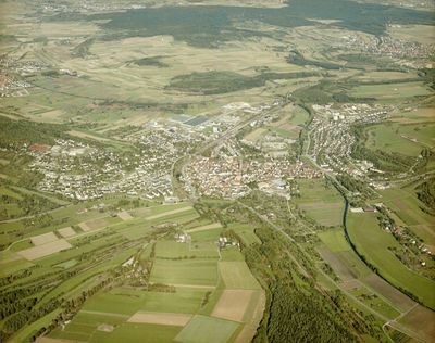
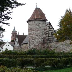
Weil der Stadt, Medieval town in Böblingen district, Germany
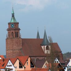
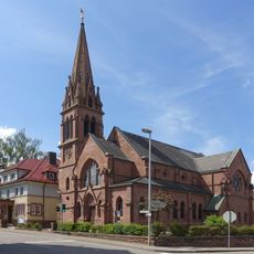
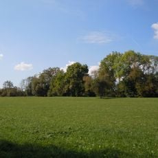
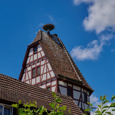
Weil der Stadt is a medieval town in the Böblingen district, located in Baden-Württemberg amid rolling landscapes. The historic center preserves old streets and buildings from different periods, showing the development of a former Free Imperial City.
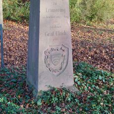
The town received its first documented mention in 1201, and was later granted the status of Free Imperial City in the 13th century. This elevation to imperial rank shaped its development and political importance over several centuries.
The Johannes Kepler Museum shows the life of the renowned astronomer born here, and his legacy shapes how the town sees itself. Local residents and visitors alike connect this place to scientific discovery and intellectual achievement.
The central railway station provides regular connections to Stuttgart, making it easy to visit from the city. The town center is walkable, and streets are easy to navigate, especially the historic area around the old squares.
During World War II, French artillery forces halted their attack after learning that the astronomer Johannes Kepler was born here. This sparing of the town due to scientific prestige is an unusual episode in wartime history.
Location: Böblingen district
Inception: 13 century
Elevation above the sea: 406 m
Shares border with: Simmozheim, Ostelsheim, Grafenau, Magstadt, Renningen, Bad Liebenzell, Heimsheim, Tiefenbronn, Neuhausen
Website: https://weil-der-stadt.de
GPS coordinates: 48.75010,8.87071
Latest update: December 14, 2025 18:04
St. Peter und Paul
67 m
Büchelberg
5.9 km
Ulrichstein
4.7 km
Naturschutzgebiet Hacksberg und Steckental
2.4 km
Johannes-Brenz-Kirche (Weil der Stadt)
219 m
Merklinger Ried
1.3 km
Hörnle und Geißberg
5 km
Mittelberg
1.2 km
Heckengäu - Weil der Stadt
757 m
Simmozheimer Wald
5.2 km
Renningen
3.4 km
Würmaue am Heuberg
3.9 km
Kappelwiesen-Beim Roten Brunnen-Salzwiesen
1.6 km
Rabenturm
273 m
Hacksberg und Steckental
2.7 km
St. Johannes der Täufer
4.6 km
Storchenturm
324 m
3 Linden am Ulrichsdenkmal
4.6 km
Kita Regenbogen
4.6 km
Gehölzbestand u. Halbtrockenrasenfl. Predigtplatz
2.2 km
Hacksberg und Steckental (Landkreis Calw)
2.3 km
Schloßpark-Dätzingen
3.8 km
3 Linden
3.3 km
2 Linden am Altbach
3.6 km
Eiche am Altbach
3.6 km
Doline Grandeloch
6.8 km
Roter Turm
392 m
Halbtrockenrasenfläche Oberer Käppelesberg
2.4 kmVisited this place? Tap the stars to rate it and share your experience / photos with the community! Try now! You can cancel it anytime.
Discover hidden gems everywhere you go!
From secret cafés to breathtaking viewpoints, skip the crowded tourist spots and find places that match your style. Our app makes it easy with voice search, smart filtering, route optimization, and insider tips from travelers worldwide. Download now for the complete mobile experience.
A unique approach to discovering new places❞
— Le Figaro
All the places worth exploring❞
— France Info
A tailor-made excursion in just a few clicks❞
— 20 Minutes