Chest opened
+${chestReward.xp} XP
Explorer
NOUVEAU ×${chestReward.collectible.quantity}
tapez pour fermer
Chest locked

Open chests in the app

Around Us is built for your phone — chests unlock when you walk, explore and capture nearby places.

Enable Location

We need your location to show you interesting places around you

Discover nearby places

Find interesting locations and hidden gems around you

Precise directions

Get accurate directions and distances to places

Your location is never shared with other users. It's only used when you tap the location button.

Tambach-Dietharz

Log in to your account

Start exploring — it's free

Trusted by 72,980 travelers worldwide

Continue with Google
Continue with Apple
or

We will send you a code to connect

By continuing, you accept our Terms and Conditions and our Privacy Policy

Check your inbox

We've sent a pincode in your inbox. Please enter the code below.

Discussion Reviews 1 Photos
17.4k Popularity

Tambach-Dietharz, municipality of Germany

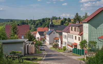
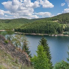
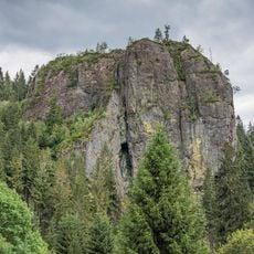
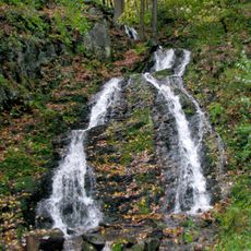
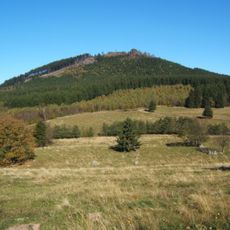
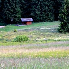
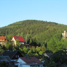
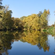
Tambach-Dietharz is a town in Thuringia situated within seven valleys at elevations between 1,475 and 2,900 feet (450 to 886 meters) and surrounded by forests and mountains. The area features over 170 kilometers of marked trails and several lakes, including Bergsee Ebertswiese and Falkenstein, a nearly 330-foot (100-meter) rock formation for climbing.

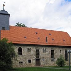
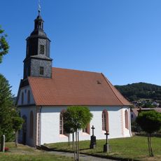
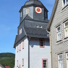
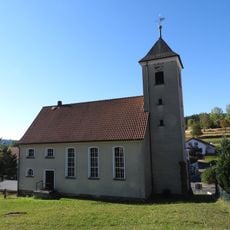
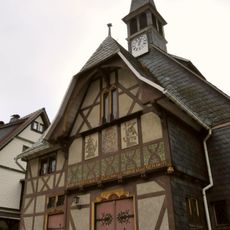
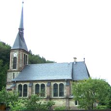
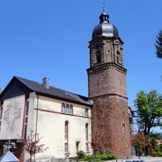
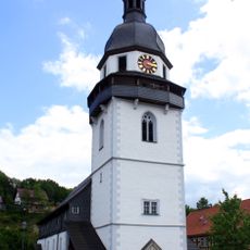
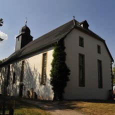
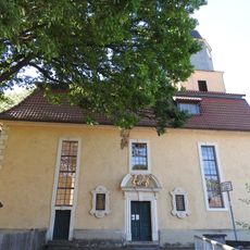
The town originated from two settlements first documented in the mid-1200s and grew as a stop along the Magna Strada, an old trade route connecting Leipzig and Frankfurt. The Lutherkirche, built around 1350, was rebuilt twice after fires and stands as a witness to this long history.

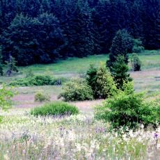
The town takes its name from two historical settlements that developed within seven valleys, with the names reflecting their geographic location. Today the valleys and forests shape how visitors experience and move through the landscape.

The area is ideal for hiking and cycling on well-marked paths, with many sites like Spitterfall and Falkenstein easily accessible from town. The region offers year-round activities: winter visitors can enjoy cross-country skiing at higher elevations, while warmer months are perfect for swimming in the forest pool.

Local legend claims that Martin Luther drank water from a small spring in the area during his stay, and the water supposedly helped with health issues after a strenuous hike along the Rennsteig trail. Though unproven, locals cherish this story, which adds special character to the place.

The community of curious travelers

AroundUs brings together thousands of curated places, local tips, and hidden gems, enriched daily by 60,000 contributors worldwide.

Start exploring
Location
Elevation above the sea
450 m
GPS coordinates
50.79245,10.61568
Latest update
February 17, 2026 00:40
Reviews
Share your experience

No review yet

Discussions
Start a discussion...

No discussion yet

« Tambach-Dietharz - municipality of Germany » is provided by Around Us (aroundus.com). Images and texts are derived from Wikimedia project under a Creative Commons license. You are allowed to copy, distribute, and modify copies of this page, under the conditions set by the license, as long as this note is clearly visible.

Discover hidden gems everywhere you go!

From secret cafés to breathtaking viewpoints, skip the crowded tourist spots and find places that match your style. Our app makes it easy with voice search, smart filtering, route optimization, and insider tips from travelers worldwide. Download now for the complete mobile experience.

Around Us App Screenshot

A unique approach to discovering new places

Le Figaro

All the places worth exploring

France Info

A tailor-made excursion in just a few clicks

20 Minutes

Around Us
Travel Guide & Maps
Download

Send to your phone

QR Code
1

Open the camera app on your mobile.

2

Point at the QR code with your camera. A notification will appear.

3

Tap the notification to open the link.