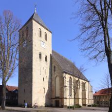
Baumberge, Mountain range in Münsterland, Germany.
The Baumberge is a mountain range stretching between Münster and Coesfeld in Münsterland, with Westerberg as the highest point at 187.6 meters. The landscape displays a flat, forested plateau with steep edges and numerous depressions created by karst processes.
The Baumberge are made of a porous calcareous sandstone, so rainwater on the plateau seeps away to great depth. For centuries the farms here drew drinking water from wells 40 to 50 metres deep, and often relied on rainwater cisterns instead, until a drinking water main reached them in the early 1970s. The water resurfaces at the edges of the hills in springs, sometimes forming whole streams within a few metres.
The name Baumberge derives from Bomberg, a fusion of the Old German word bo, meaning house or farm, with the god Odin. The range is divided into the Bomberge, Osterwicker Platte, Coesfeld-Daruper Höhen and Schöppinger Rücken. Billerbeck lies in the valley of the Berkel where three of these units meet.
The area is easily reached via the regional road network with several access points depending on where you start. Be aware that the plateau can become slippery in wet weather, so sturdy shoes are a good idea.
Because the porous sandstone lets rainwater sink deep underground, the farms on the plateau relied for centuries on wells 40 to 50 metres deep, and often on rainwater cisterns, until a drinking water main reached them in the early 1970s. The water resurfaces at the edges of the hills as springs, sometimes forming whole streams within a few metres.
The community of curious travelers
AroundUs brings together thousands of curated places, local tips, and hidden gems, enriched daily by 94,524 contributors worldwide.