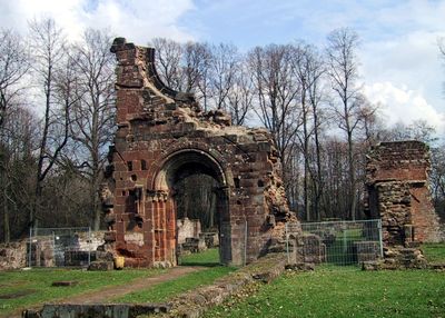
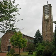
Wörschweiler Abbey, Cistercian monastery ruins in Homburg, Germany.
Wörschweiler Abbey is a Cistercian monastery whose stone ruins sit on Marienberg mountain and display medieval construction methods. The preserved walls and foundations reveal how monks organized their religious community and the scale of their buildings.
Count Friedrich of Saarwerden and his wife Gertrud founded the monastery in 1131, which later came under the authority of Villers-Bettnach Abbey. This affiliation strengthened the monastery's ties to Cistercian practices and discipline.
The monastery served as a center where monks copied religious texts and preserved knowledge through manuscript work. This intellectual activity connected the community to a wider network of religious houses across Europe.
The site is accessible year-round and sits on a hillside, so expect uneven terrain when walking around. Sturdy shoes and time to explore the walls and surrounding landscape are recommended.
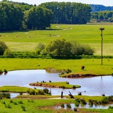
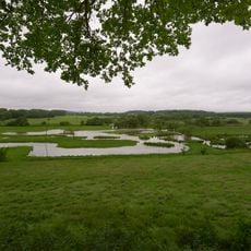
The monastery used its hilltop location to create a clever water system that diverted streams and supported farming across the land. This engineering shows how resourceful and organized the monks were in running their community.
Location: Homburg
Inception: 1130
Website: http://kloster-woerschweiler.de
GPS coordinates: 49.28422,7.30737
Latest update: December 11, 2025 18:09
St. Fronleichnam
3.9 km
Klinikkirche Homburg
3.5 km
Alte Burg
2.2 km
St. Remigius
2.7 km
Schlangenhöhle
1.1 km
Gallo-Roman temple at Bierbach
1.8 km
Christuskirche
772 m
Mariä Geburt (Schwarzenacker)
919 m
Apostelkirche
2.1 km
Höllengraben
2.7 km
Taubental
3.5 km
Landschaftsschutzgebiet "Beeder Bruch" (L 6609-308)
3.2 km
Naturschutzgebiet "Limbacher Sanddüne" (N 6609-306)
2.8 km
Gackelsberg und Hirschberg suedllich von Limbach
2.5 km
Waldgebiet westlich Woerschweiler mit Gruenland, Brachen und Feldgehoelzen
850 m
Beedener Bruch
3 km
Bliesaue mit Gruenland, Brachen, Auwaldfragmenten, stehendem und fliessendem Gewaesser, Begleitgehoelz
520 m
Bliestal von der Kreisgrenze im Norden bis zur Gemeindegrenze im Sueden
3.4 km
Edelhof
639 m
Unglücksfels
4.1 km
Bliesberger Hof Brücke
3 km
Brücke
2.7 km
Limbacher Sanddüne
2.8 km
Bliesaue bei Beeden
1.7 km
Hügel Gloria Romanorum
198 m
Schule
1.8 km
Klosterberg
1 km
Hauptstraße 60
2.1 kmVisited this place? Tap the stars to rate it and share your experience / photos with the community! Try now! You can cancel it anytime.
Discover hidden gems everywhere you go!
From secret cafés to breathtaking viewpoints, skip the crowded tourist spots and find places that match your style. Our app makes it easy with voice search, smart filtering, route optimization, and insider tips from travelers worldwide. Download now for the complete mobile experience.
A unique approach to discovering new places❞
— Le Figaro
All the places worth exploring❞
— France Info
A tailor-made excursion in just a few clicks❞
— 20 Minutes