Chest opened
+${chestReward.xp} XP
Explorer
NOUVEAU ×${chestReward.collectible.quantity}
tapez pour fermer
Chest locked

Open chests in the app

Around Us is built for your phone — chests unlock when you walk, explore and capture nearby places.

Enable Location

We need your location to show you interesting places around you

Discover nearby places

Find interesting locations and hidden gems around you

Precise directions

Get accurate directions and distances to places

Your location is never shared with other users. It's only used when you tap the location button.

Klever Reichswald

Log in to your account

Start exploring — it's free

Trusted by 72,878 travelers worldwide

Continue with Google
Continue with Apple
or

We will send you a code to connect

By continuing, you accept our Terms and Conditions and our Privacy Policy

Check your inbox

We've sent a pincode in your inbox. Please enter the code below.

Klever Reichswald
Discussion Reviews 1 Photos
10.5k Popularity

Klever Reichswald, State forest in North Rhine-Westphalia, Germany.

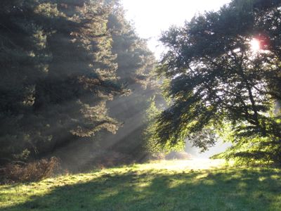
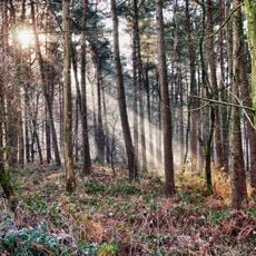
Klever Reichswald is a large continuous forest spanning across several municipalities in the Lower Rhine area. It features a mix of different tree types and rolling terrain crossed by walking trails that connect the various sections.

The forest took its present form during the Ice Age when glaciers shaped the landscape. During the 20th century, it became the site of intense fighting between German troops and allied forces in a major campaign.

People from the surrounding towns come here to walk and spend time outdoors in nature. The woodland serves as a gathering place where locals connect with the landscape and each other through daily visits and weekend outings.

The forest has multiple entry points and parking areas near the different towns where visitors can leave their vehicles. The walking routes are clearly marked, and there are rest spots along the paths where you can take a break.

The area was shaped by glaciers during the Ice Age, creating hills that stand out noticeably from the flat Rhine landscape. The highest point of these raised areas reaches roughly 95 meters in elevation.

The community of curious travelers

AroundUs brings together thousands of curated places, local tips, and hidden gems, enriched daily by 60,000 contributors worldwide.

Start exploring
Location
Location
Location
Location
Elevation above the sea
73 m
Part of
Lower Rhine Heights
GPS coordinates
51.74778,6.01528
Latest update
March 21, 2026 22:10
Reviews
Share your experience

No review yet

Discussions
Start a discussion...

No discussion yet

« Klever Reichswald - State forest in North Rhine-Westphalia, Germany » is provided by Around Us (aroundus.com). Images and texts are derived from Wikimedia project under a Creative Commons license. You are allowed to copy, distribute, and modify copies of this page, under the conditions set by the license, as long as this note is clearly visible.

Discover hidden gems everywhere you go!

From secret cafés to breathtaking viewpoints, skip the crowded tourist spots and find places that match your style. Our app makes it easy with voice search, smart filtering, route optimization, and insider tips from travelers worldwide. Download now for the complete mobile experience.

Around Us App Screenshot

A unique approach to discovering new places

Le Figaro

All the places worth exploring

France Info

A tailor-made excursion in just a few clicks

20 Minutes

Around Us
Travel Guide & Maps
Download

Send to your phone

QR Code
1

Open the camera app on your mobile.

2

Point at the QR code with your camera. A notification will appear.

3

Tap the notification to open the link.