Chest opened
+${chestReward.xp} XP
Explorer
NOUVEAU ×${chestReward.collectible.quantity}
tapez pour fermer
Chest locked

Open chests in the app

Around Us is built for your phone — chests unlock when you walk, explore and capture nearby places.

Enable Location

We need your location to show you interesting places around you

Discover nearby places

Find interesting locations and hidden gems around you

Precise directions

Get accurate directions and distances to places

Your location is never shared with other users. It's only used when you tap the location button.

Log in to your account

Start exploring — it's free

Trusted by 72,888 travelers worldwide

Continue with Google
Continue with Apple
or

We will send you a code to connect

By continuing, you accept our Terms and Conditions and our Privacy Policy

Check your inbox

We've sent a pincode in your inbox. Please enter the code below.

Grenzlandring
Discussion Reviews Photo
16.4k Popularity

Grenzlandring, road in Germany

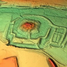
The Grenzlandring is an oval-shaped concrete road approximately 9 kilometers long that loops around the town of Wegberg in North Rhine-Westphalia. Originally built as a supply and transport route, it now functions as a regular road designated as L 3 and L 400.

The road was built before World War II as a military supply route. From 1948 to 1952 it hosted international car and motorcycle races before a fatal accident in 1952 killed 13 people and led to the permanent banning of racing events.

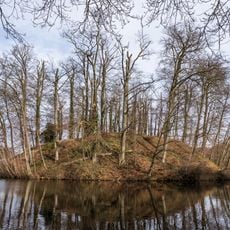
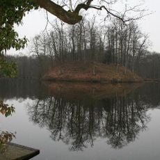
The Grenzlandring remains a place of local memory in the Wegberg region, where its name still carries weight among those who know its past. A memorial stone placed in 2012 stands as a quiet reminder for visitors and residents of the lives lost here.

The road is now a standard route that can be explored by car or on foot. Visitors should note there are no dedicated visitor facilities or museums at the site, but a memorial stone marking the 1952 accident location is accessible.

Though the road appears unremarkable today, racing drivers achieved record-breaking speeds exceeding 200 kilometers per hour (125 mph) here between 1948 and 1952 on the smooth concrete surface. The 9-kilometer circuit was known as one of Europe's fastest racing courses and was often compared to the famous Avus racetrack.

The community of curious travelers

AroundUs brings together thousands of curated places, local tips, and hidden gems, enriched daily by 60,000 contributors worldwide.

Start exploring
GPS coordinates
51.13890,6.28833
Latest update
February 17, 2026 02:00
Reviews
Share your experience

No review yet

Discussions
Start a discussion...

No discussion yet

« Grenzlandring - road in Germany » is provided by Around Us (aroundus.com). Images and texts are derived from Wikimedia project under a Creative Commons license. You are allowed to copy, distribute, and modify copies of this page, under the conditions set by the license, as long as this note is clearly visible.

Discover hidden gems everywhere you go!

From secret cafés to breathtaking viewpoints, skip the crowded tourist spots and find places that match your style. Our app makes it easy with voice search, smart filtering, route optimization, and insider tips from travelers worldwide. Download now for the complete mobile experience.

Around Us App Screenshot

A unique approach to discovering new places

Le Figaro

All the places worth exploring

France Info

A tailor-made excursion in just a few clicks

20 Minutes

Around Us
Travel Guide & Maps
Download

Send to your phone

QR Code
1

Open the camera app on your mobile.

2

Point at the QR code with your camera. A notification will appear.

3

Tap the notification to open the link.