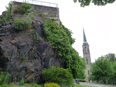
Burg Falkenstein, Medieval castle in Falkenstein, Germany.
Burg Falkenstein is a stone castle set on elevated ground in the Vogtland region of Saxony, featuring defensive walls and a partially collapsed well tower. The ruins display clear foundations and remaining fortification structures that reveal how the medieval fortress was organized.
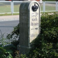
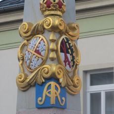
In the 12th century, the noble family of Lutzelbourg founded the castle as a strategic stronghold in the region. The site underwent various reconstructions and destruction over time before becoming the ruin it is today.
The castle draws people for medieval reenactments and educational events where visitors can watch regional craftwork and historical practices demonstrated firsthand.
The castle ruins are freely accessible during daylight hours with no entrance fees. Wear sturdy footwear as the ground is uneven and some areas may be slippery or unstable.
Traces of squirrel wheels remain in the castle walls, medieval lifting devices that transported supplies and materials to higher levels of the fortress. These rare remnants show how castle residents solved the practical challenges of living in a fortress.
Location: Falkenstein, Saxony
GPS coordinates: 50.47640,12.36980
Latest update: December 9, 2025 12:25
Talsperre Falkenstein
1.4 km
Talsperre Werda
5.4 km
Schlossturm Auerbach
4.2 km
Rittergut Adlershof
5.1 km
Heimatmuseum Falkenstein
4.3 km
Schloss Falkenstein
49 m
Am alten Floßgraben
4.7 km
Schlossturm
4.2 km
Kirche Kirchplatz 5
4.3 km
Schule Bahnhofstraße 14
3.3 km
Haltepunkt Ellefeld
1.2 km
Kgl.-sächs. Postmeilenstein Poppengrün
4.1 km
Platzanlage Altmarkt
4.2 km
Townhall in Frankenstein
168 m
Polish-Saxon Post Milestone in Auerbach/Vogtl.
4.2 km
Sogenanntes Oberes Schloss Hammerbrücker Straße 4 + 4a
1.1 km
Zum Heiligen Kreuz
128 m
Am alten Floßgraben
4.7 km
Triebtalgebiet
4.7 km
Sachgesamtheit Rittergut und Schloss Falkenstein Schloßplatz 1
49 m
Station 142 Wendelstein
2.8 km
Bahnhof Grünbach Grünbach (Sachsen)
4.1 km
Water tower Rebesgrüner Höhe
4.6 km
Kirche mit Pfarr- und Gemeindehaus sowie Einfriedung Rempesgrüner Weg 9
4 km
Turm und Gaststättengebäude mit Terrasse Schloßstraße 8a
4.2 km
Postamt Poststraße 1
2.9 km
Talsperre Werda; Geigenbachtalsperre Werda
5.5 km
Mietshaus Dr.-Wilhelm-Külz-Straße 54
565 mVisited this place? Tap the stars to rate it and share your experience / photos with the community! Try now! You can cancel it anytime.
Discover hidden gems everywhere you go!
From secret cafés to breathtaking viewpoints, skip the crowded tourist spots and find places that match your style. Our app makes it easy with voice search, smart filtering, route optimization, and insider tips from travelers worldwide. Download now for the complete mobile experience.
A unique approach to discovering new places❞
— Le Figaro
All the places worth exploring❞
— France Info
A tailor-made excursion in just a few clicks❞
— 20 Minutes