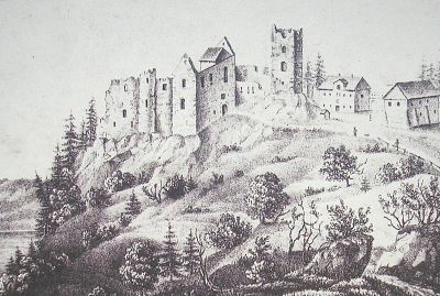
Burg Rothenfels, Medieval castle ruin in Immenstadt, Germany
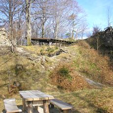
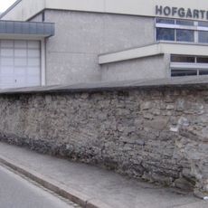
Burg Rothenfels is a castle ruin near Immenstadt featuring stone walls built on elevated ground that display construction methods from different medieval periods. The remains are accessible via marked hiking trails and show the design principles of medieval fortifications.
The castle was founded during the Middle Ages as a strategic defensive post and gradually declined through regional conflicts and shifting political conditions. Over centuries, the structure deteriorated until only ruins remained that still mark the landscape today.
The castle walls reveal how medieval builders adapted their construction methods to the local landscape and defensive needs. Walking through the ruins, visitors can observe the practical solutions craftspeople used when building on steep terrain.
The climb to the ruins follows well-marked hiking trails starting from Immenstadt, gradually ascending to the site. Informational panels at the location help visitors understand the layout and different construction phases of the fortification.
The foundations are unusually thick, showing how builders had to compensate for the steep slope to keep the structure stable. These massive substructures remain clearly visible today and offer rare insight into medieval engineering techniques.
The community of curious travelers
AroundUs brings together thousands of curated places, local tips, and hidden gems, enriched daily by 60,000 contributors worldwide.