Chest opened
+${chestReward.xp} XP
Explorer
NOUVEAU ×${chestReward.collectible.quantity}
tapez pour fermer
Chest locked

Open chests in the app

Around Us is built for your phone — chests unlock when you walk, explore and capture nearby places.

Enable Location

We need your location to show you interesting places around you

Discover nearby places

Find interesting locations and hidden gems around you

Precise directions

Get accurate directions and distances to places

Your location is never shared with other users. It's only used when you tap the location button.

Log in to your account

Start exploring — it's free

Trusted by 72,890 travelers worldwide

Continue with Google
Continue with Apple
or

We will send you a code to connect

By continuing, you accept our Terms and Conditions and our Privacy Policy

Check your inbox

We've sent a pincode in your inbox. Please enter the code below.

Erzengler Teich
Discussion Reviews Photo
1.6k Popularity

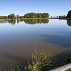
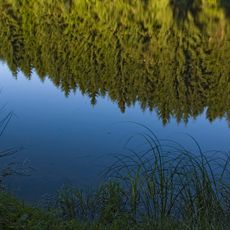
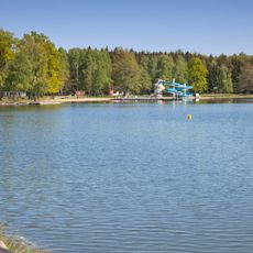
Erzengler Teich, reservoir

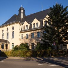
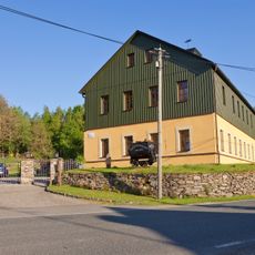
The Erzengler Teich is a reservoir near Brand-Erbisdorf, created in the late 1500s for mining operations and serving multiple purposes today. The water body is fed by the Münzbach stream, covers about 8 hectares of water surface, and sits nestled in forest that moderates temperature and provides a sheltered setting.

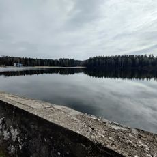
The reservoir was constructed between 1569 and 1570 to supply water to nearby mines through artificial channels. During the 1800s, the structure was reinforced and upgraded with new materials, and from 1912 onward recreational use was introduced, with official bathing operations opening in 1931.

The Erzengler Teich originally served mining operations, but since the 1930s it has become a place where people gather for swimming and leisure activities. The wooded surroundings and pathways shape how visitors experience the site today, with activities ranging from bathing to fishing and walking around the water.

Bathing water is regularly tested and meets EU quality standards for swimming areas. The swimming zone is marked with buoys, with shallow areas for non-swimmers and children, plus rental options for rowing and paddle boats for additional activities.

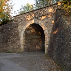
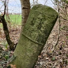
Though the reservoir is today mainly known as a bathing spot, it was originally connected to a network of other ponds through underground channels that supplied water to the region's entire mining system. This hidden infrastructure reveals the engineering skill of earlier times, now lying beneath the surface.

The community of curious travelers

AroundUs brings together thousands of curated places, local tips, and hidden gems, enriched daily by 60,000 contributors worldwide.

Start exploring
Location
GPS coordinates
50.85220,13.33940
Latest update
February 9, 2026 08:19
Around this place
Elite vehicles
Germany

Elite vehicles

1.7 km
Alte Mordgrube
Germany

Alte Mordgrube

2 km
Stadtkirche Brand-Erbisdorf
Germany

Stadtkirche Brand-Erbisdorf

1.6 km
Kohlbach-Kunstgraben
Germany

Kohlbach-Kunstgraben

950 m
Rothbächer Teich
Germany

Rothbächer Teich

621 m
Lother Teich
Germany

Lother Teich

959 m
Theater der Freundschaft
Germany

Theater der Freundschaft

1.9 km
Erzengelteich
Germany

Erzengelteich

85 m
Bartholomäusschacht
Germany

Bartholomäusschacht

1.6 km
Eisenbahnbrücke
Germany

Eisenbahnbrücke

1.9 km
Huthaus; Alte Mordgrube Fundgrube; Vereinigt Feld bei Brand; Königliche Mittelgrube; Lederwerke Moritz Stecher; Alte Mordgrube (Sachgesamtheit); Brander Revier (Sachgesamtheit) Brand-Erbisdorf
Germany

Huthaus; Alte Mordgrube Fundgrube; Vereinigt Feld bei Brand; Königliche Mittelgrube; Lederwerke Moritz Stecher; Alte Mordgrube (Sachgesamtheit); Brander Revier (Sachgesamtheit) Brand-Erbisdorf

2 km
Neu Glück und Drei Eichen Fundgrube; Vereinigt Feld bei Brand; Königliche Mittelgrube; Brander Revier (Sachgesamtheit) Brand-Erbisdorf
Germany

Neu Glück und Drei Eichen Fundgrube; Vereinigt Feld bei Brand; Königliche Mittelgrube; Brander Revier (Sachgesamtheit) Brand-Erbisdorf

1.2 km
Einzeldenkmal in o. g. Sachgesamtheit: ehemalige Bergschmiede, heute Wohnhaus (siehe auch Sachgesamtheitsdokument »Brander Revier« - obj. 09208604) Vereinigt Feld 1
Germany

Einzeldenkmal in o. g. Sachgesamtheit: ehemalige Bergschmiede, heute Wohnhaus (siehe auch Sachgesamtheitsdokument »Brander Revier« - obj. 09208604) Vereinigt Feld 1

1.3 km
Eisenbahnbrücke Brandsteig; Eisenbahnstrecke Berthelsdorf – Großhartmannsdorf mit Abzw Brand – Langenau Brand-Erbisdorf
Germany

Eisenbahnbrücke Brandsteig; Eisenbahnstrecke Berthelsdorf – Großhartmannsdorf mit Abzw Brand – Langenau Brand-Erbisdorf

1.9 km
Pfarrhaus und Seitengebäude mit Einfriedungsmauer entlang des Kirchweges Kirchweg 4
Germany

Pfarrhaus und Seitengebäude mit Einfriedungsmauer entlang des Kirchweges Kirchweg 4

1.6 km
Wohnhaus Am Teich 6
Germany

Wohnhaus Am Teich 6

1.4 km
Gasthof (ohne Saalanbau) Großhartmannsdorfer Straße 14
Germany

Gasthof (ohne Saalanbau) Großhartmannsdorfer Straße 14

1.6 km
Wegestein Berthelsdorf/Erzgeb.
Germany

Wegestein Berthelsdorf/Erzgeb.

1.6 km
Pochhäusel; Neu Glück und Drei Eichen Fundgrube; Vereinigt Feld bei Brand; Königliche Mittelgrube; Brander Revier (Sachgesamtheit) Brand-Erbisdorf
Germany

Pochhäusel; Neu Glück und Drei Eichen Fundgrube; Vereinigt Feld bei Brand; Königliche Mittelgrube; Brander Revier (Sachgesamtheit) Brand-Erbisdorf

1.1 km
Neu Glück Drei Eichner Treibeschacht; Neu Glück und Drei Eichen Fundgrube; Vereinigt Feld bei Brand; Königliche Mittelgrube; Brander Revier (Sachgesamtheit) Brand-Erbisdorf
Germany

Neu Glück Drei Eichner Treibeschacht; Neu Glück und Drei Eichen Fundgrube; Vereinigt Feld bei Brand; Königliche Mittelgrube; Brander Revier (Sachgesamtheit) Brand-Erbisdorf

1.1 km
Erzengler Teich; Brander Revier (Sachgesamtheit); Revierwasserlaufanstalt (Sachgesamtheit) Brand-Erbisdorf
Germany

Erzengler Teich; Brander Revier (Sachgesamtheit); Revierwasserlaufanstalt (Sachgesamtheit) Brand-Erbisdorf

136 m
Ehemals Amtsgericht, heute Polizeigebäude Hauptstraße 19
Germany

Ehemals Amtsgericht, heute Polizeigebäude Hauptstraße 19

1.9 km
Wegestein Brand-Erbisdorf
Germany

Wegestein Brand-Erbisdorf

1.9 km
Gesenkhammer; Pressund Schmiedewerk (ehem.) Brand-Erbisdorf
Germany

Gesenkhammer; Pressund Schmiedewerk (ehem.) Brand-Erbisdorf

2 km
Gedenkstein Freiwald -
Germany

Gedenkstein Freiwald -

1.1 km
Obersilberschnur obere 13. bis 20. Maß; Brander Revier (Sachgesamtheit) Brand-Erbisdorf
Germany

Obersilberschnur obere 13. bis 20. Maß; Brander Revier (Sachgesamtheit) Brand-Erbisdorf

1.3 km
Wappenstein Freiwald -
Germany

Wappenstein Freiwald -

402 m
Transformatorenhäuschen Brand-Erbisdorf
Germany

Transformatorenhäuschen Brand-Erbisdorf

1.8 km
Show the full map
Reviews
Share your experience

No review yet

Discussions
Start a discussion...

No discussion yet

« Erzengler Teich - reservoir » is provided by Around Us (aroundus.com). Images and texts are derived from Wikimedia project under a Creative Commons license. You are allowed to copy, distribute, and modify copies of this page, under the conditions set by the license, as long as this note is clearly visible.

Discover hidden gems everywhere you go!

From secret cafés to breathtaking viewpoints, skip the crowded tourist spots and find places that match your style. Our app makes it easy with voice search, smart filtering, route optimization, and insider tips from travelers worldwide. Download now for the complete mobile experience.

Around Us App Screenshot

A unique approach to discovering new places

Le Figaro

All the places worth exploring

France Info

A tailor-made excursion in just a few clicks

20 Minutes

Around Us
Travel Guide & Maps
Download

Send to your phone

QR Code
1

Open the camera app on your mobile.

2

Point at the QR code with your camera. A notification will appear.

3

Tap the notification to open the link.