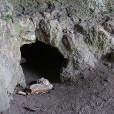
Hohler Fels, Archaeological cave in Happurg, Germany.
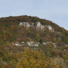
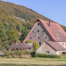
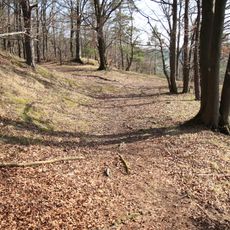
Hohler Fels is a karst cave in Happurg that extends approximately 200 meters in length and 70 meters in width. The entrance faces south, reaches about 6 meters (20 feet) in height, and sits at around 546 meters (1,790 feet) above sea level, positioned directly beneath the remains of a Celtic fortress.
Scientific exploration began in 1906 and 1912 when Konrad Hörmann conducted excavations and discovered remains of Ice Age animals and human artifacts. These finds show that different peoples lived here from the Middle Paleolithic period through the Iron Age.
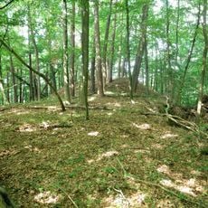
The cave entrance sits directly beneath a former Celtic settlement, showing how people sought out this location over thousands of years. Different layers of findings tell the story of various groups who lived here and left their mark.
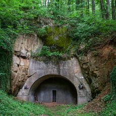
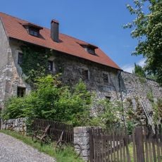
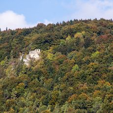
The entrance is easily accessible and the cave can be viewed from outside as you approach the base of the cliff. When you stand beneath the former Houbirg settlement, you are looking at one of the region's oldest human dwellings.
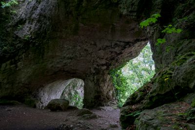
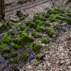
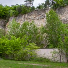
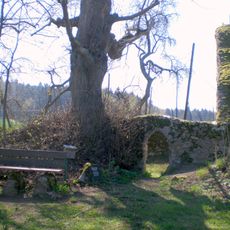
A natural arch with two vaults stands in front of the cave entrance, creating a distinctive geological feature that sets this location apart from other caves. This stone arch was shaped by erosion over millions of years, framing the cave entrance in an unusual way.
Location: Happurg
Elevation above the sea: 546 m
Length: 200 m
Width: 70 m
Accessibility: Wheelchair inaccessible
Part of: Cultural heritage D-5-6534-0014 Happurg
GPS coordinates: 49.48466,11.49220
Latest update: December 12, 2025 09:07
Happurger See
873 m
Doggerwerk in Happurg
1.1 km
Houbirg
892 m
Burgruine in Happurg
1.2 km
Burgstall Hacburg
1.3 km
Burgstall Altes Haus (Pommelsbrunn)
2.1 km
KZ-Mahnmal bei Förrenbach
874 m
Kalktuffterrasse von Kainsbach
2.3 km
Evangelisch-lutherisch Filialkirche in Happurg
1.9 km
St. Johannes
1.2 km
Ruine der Kapelle St. Rochus und St. Leonhard in Pommelsbrunn
1.6 km
Cultural heritage D-5-6534-0014 Happurg
20 m
Mühle in Pommelsbrunn
2.3 km
Wasserbergfelsen
1.8 km
Cultural heritage D-5-6534-0025 in Happurg
1.2 km
Steinbruch nordöstlich von Happurg
1.5 km
Wohnstallhaus in Happurg
1.3 km
Cultural heritage D-5-6535-0119 in Happurg
1.2 km
Cultural heritage D-5-6534-0171 in Happurg
1.9 km
Cultural heritage D-5-6534-0166 in Happurg
1.7 km
Bauernhof, Wohnstallhaus in Pommelsbrunn
1.3 km
Nebengebäude in Happurg
1.8 km
Mühlgraben Arzloher Straße 7 (D-5-74-147-1#1)
2.3 km
Stausee
872 m
Mittlelalterliche Befunde in Pommelsbrunn
1.6 km
Ringwallanlage auf der Mühlkoppe
2.1 km
Sandweg 14
1.1 km
Felsenkeller Seer Straße
1.5 kmVisited this place? Tap the stars to rate it and share your experience / photos with the community! Try now! You can cancel it anytime.
Discover hidden gems everywhere you go!
From secret cafés to breathtaking viewpoints, skip the crowded tourist spots and find places that match your style. Our app makes it easy with voice search, smart filtering, route optimization, and insider tips from travelers worldwide. Download now for the complete mobile experience.
A unique approach to discovering new places❞
— Le Figaro
All the places worth exploring❞
— France Info
A tailor-made excursion in just a few clicks❞
— 20 Minutes