Chest opened
+${chestReward.xp} XP
Explorer
NOUVEAU ×${chestReward.collectible.quantity}
tapez pour fermer

See the monuments around you in AR Open chests in the app

Around Us is built for your phone — point your camera at the streets and discover the monuments and places around you in augmented reality. Around Us is built for your phone — chests unlock when you walk, explore and capture nearby places.

•

Enable Location

We need your location to show you interesting places around you

Discover nearby places

Find interesting locations and hidden gems around you

Precise directions

Get accurate directions and distances to places

Your location is never shared with other users. It's only used when you tap the location button.

Hügelgräber-Heide bei Kirchlinteln

Log in to your account

Start exploring — it's free

Trusted by 94,645 travelers worldwide

Continue with Google
Continue with Apple
or

We will send you a code to connect

By continuing, you accept our Terms and Conditions and our Privacy Policy

Check your inbox

We've sent a pincode in your inbox. Please enter the code below.

Hügelgräber-Heide bei Kirchlinteln

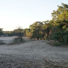
Hügelgräber-Heide bei Kirchlinteln, Protected natural area in Kirchlinteln, Germany.

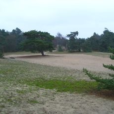
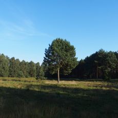
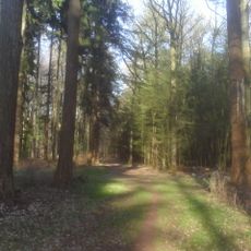
Hügelgräber-Heide bei Kirchlinteln is a 9-hectare nature reserve whose open heath covers about 7.9 hectares, the rest being mixed woodland of Scots pine, birch, red oak and Douglas fir. A waymarked trail with information boards and benches crosses the site, and the 1991 Rinnenstein stands in the northern section.

The area contains 18 burial mounds from the Bronze Age between 2500 and 1400 BC, built along ancient trade routes crossing the region. These earthworks reveal early settlement patterns and the region's role in trade networks.

The heathland supported specialized wildlife species for centuries and was shaped by shepherds who grazed sheep across the open land. This traditional use remains visible in the landscape structure you see today.

The trails are accessible from Kirchlinteln and clearly marked for easy navigation. Wear sturdy footwear since the terrain is uneven and can become wet after rainfall.

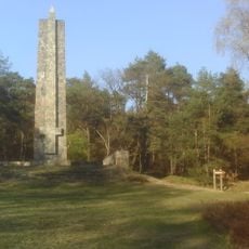
In the northern part of the reserve stands the Rinnenstein, a boulder found in 1991 and set up there. Its most likely artificial groove is of unknown age and purpose. The site also lies on the Stadtmusikantenradweg cycle route, which follows the old Salz- or Postweg; legend has the Bremen Town Musicians walking this road.

The community of curious travelers

AroundUs brings together thousands of curated places, local tips, and hidden gems, enriched daily by 94,645 contributors worldwide.

Start exploring
Location
Inception
1936
GPS coordinates
52.93170,9.31639
Latest update
November 4, 2026 08:49
Reviews
Share your experience

No review yet

Discussions
Start a discussion...

No discussion yet

« Hügelgräber-Heide bei Kirchlinteln - Protected natural area in Kirchlinteln, Germany » is provided by Around Us (aroundus.com). Images and texts are derived from Wikimedia project under a Creative Commons license. You are allowed to copy, distribute, and modify copies of this page, under the conditions set by the license, as long as this note is clearly visible.

Discover hidden gems everywhere you go!

From secret cafés to breathtaking viewpoints, skip the crowded tourist spots and find places that match your style. Our app makes it easy with voice search, smart filtering, route optimization, and insider tips from travelers worldwide. Download now for the complete mobile experience.

Around Us App Screenshot
❝

A unique approach to discovering new places❞

— Le Figaro

❝

All the places worth exploring❞

— France Info

❝

A tailor-made excursion in just a few clicks❞

— 20 Minutes

Around Us
Travel Guide & Maps
Download

Send to your phone

QR Code
1

Open the camera app on your mobile.

2

Point at the QR code with your camera. A notification will appear.

3

Tap the notification to open the link.