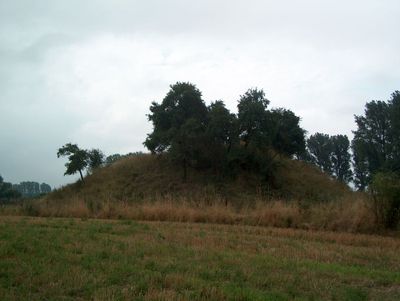
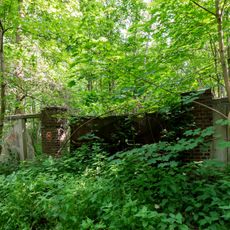
Motte Altenburg, Medieval castle ruins in Jülich, Germany.
Description
Motte Altenburg is a medieval fortified mound in Jülich consisting of an elevated earthen rampart with visible traces of water defenses. Stone foundation walls and a well lined with tuff blocks remain as evidence of the structures that once stood on top.
History
The fortification emerged in the 12th century during territorial disputes between the Counts of Jülich and the Cologne Archbishopric. It served as a strategic point in the power struggles of that era.
Culture
The mound served as a visible symbol of power and control over the surrounding lands during medieval times. Walking around it today, visitors can sense how such elevated fortifications dominated the local landscape.
Practical
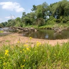
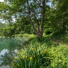
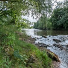
The site sits near the Rur River and is easily reached on foot from Jülich town center. Access is free and open year-round, though sturdy shoes are recommended due to uneven ground.
Did you know?
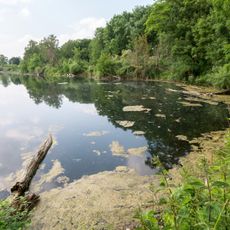
Historical maps from the 1800s reveal that the mound was surrounded by a double water moat fed directly from the Rur River. This layered defense system was an advanced protective design for its time.
AroundUs brings together thousands of curated places, local tips, and hidden gems, enriched daily by 60,000 contributors worldwide. Discover all places nearby (Jülich).
Hexenturm
3.9 km
Schloss Hambach
3.9 km
Gut Müllenark
2.2 km
St. Mariä Himmelfahrt
3.9 km
Schloss Linzenich
3.6 km
Aachener Tor
3.8 km
Immaculate Conception Church
3.3 km
Haus Lorsbeck
1.6 km
St. Rochus (Jülich)
3.4 km
Regina Pacis Chapel
833 m
Haus Pesch
3.5 km
St. Martinus (Kirchberg)
2.6 km
St. Stephanus (Selgersdorf)
1.3 km
St. Martinus (Stetternich)
3.7 km
Saint Barbara Church (Schophoven)
1.8 km
Jewish cemetery, Pier
3.5 km
Müllenarker Mühle
2.2 km
Langenbroich-Stetternicher Wald
1.8 km
Rurauenwald-Indemündung
1.3 km
Ehemaliges Eisenbahn-Ausbesserungswerk Jülich-Süd
1.3 km
Sculptures at Seecasino
2.2 km
Forschungszentrum Jülich. Zentralbibliothek
2.3 km
LSG-Baggersee Juelich-Kirchberg mit Ruruferbereich
3 km
LSG-Stetternicher Wald
3 km
Pellini-Weiher
2.7 km
Indemündung
1.6 km
Rur von Obermaubach bis Linnich
3.6 km
People pass each other
2.3 kmDiscover hidden gems everywhere you go!
From secret cafés to breathtaking viewpoints, skip the crowded tourist spots and find places that match your style. Our app makes it easy with voice search, smart filtering, route optimization, and insider tips from travelers worldwide. Download now for the complete mobile experience.
A unique approach to discovering new places❞
— Le Figaro
All the places worth exploring❞
— France Info
A tailor-made excursion in just a few clicks❞
— 20 Minutes