Enable Location

We need your location to show you interesting places around you

Discover nearby places

Find interesting locations and hidden gems around you

Precise directions

Get accurate directions and distances to places

Your location is never shared with other users. It's only used when you tap the location button.

Kohlberg

Log in to your account

Start exploring — it's free

Trusted by 63,069 travelers worldwide

Continue with Google
Continue with Apple
or

We will send you a code to connect

By continuing, you accept our Terms and Conditions and our Privacy Policy

Check your inbox

We've sent a pincode in your inbox. Please enter the code below.

Kohlberg
Discussion Reviews 1 Photos
1.7k Popularity

Kohlberg, Mountain summit in Upper Franconia, Bavaria, Germany.

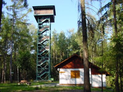
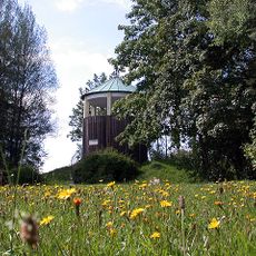
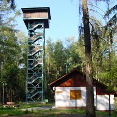
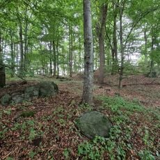
Kohlberg is a mountain summit in the Fichtelgebirge range, reaching 633 meters high and covered with thick forests of mixed deciduous and coniferous trees. A stone observation tower crowns the top, offering wide views across the Bavarian landscape and into neighboring regions.

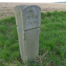
The mountain's name comes from medieval charcoal production that supplied iron furnaces in the nearby town of Arzberg. This resource extraction shaped the region for several centuries.

The Waldenfelswarte observation tower stands 33 meters high at the summit, offering views across Bavaria and into the Czech Republic.

Two marked hiking trails lead to the summit from the Siebenlindenberg parking area and are easily accessible on foot. The hike is suitable for people in average fitness and takes about one to two hours depending on the route chosen.

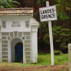
The peak earned the nickname Zuckerhut because of its cone-shaped silhouette when viewed from certain angles. This playful local name reflects the mountain's distinctive form and its role in the area's border geography.

The community of curious travelers

AroundUs brings together thousands of curated places, local tips, and hidden gems, enriched daily by 60,000 contributors worldwide.

Start exploring
Location
Elevation above the sea
633 m
Part of
Kohlwald
GPS coordinates
50.04224,12.18714
Latest update
December 14, 2025 13:07
Reviews
Share your experience

No review yet

Discussions
Start a discussion...

No discussion yet

« Kohlberg - Mountain summit in Upper Franconia, Bavaria, Germany » is provided by Around Us (aroundus.com). Images and texts are derived from Wikimedia project under a Creative Commons license. You are allowed to copy, distribute, and modify copies of this page, under the conditions set by the license, as long as this note is clearly visible.

Discover hidden gems everywhere you go!

From secret cafés to breathtaking viewpoints, skip the crowded tourist spots and find places that match your style. Our app makes it easy with voice search, smart filtering, route optimization, and insider tips from travelers worldwide. Download now for the complete mobile experience.

Around Us App Screenshot

A unique approach to discovering new places

Le Figaro

All the places worth exploring

France Info

A tailor-made excursion in just a few clicks

20 Minutes

Around Us
Travel Guide & Maps
Download

Send to your phone

QR Code
1

Open the camera app on your mobile.

2

Point at the QR code with your camera. A notification will appear.

3

Tap the notification to open the link.