Chest opened
+${chestReward.xp} XP
Explorer
NOUVEAU ×${chestReward.collectible.quantity}
tapez pour fermer
Chest locked

Open chests in the app

Around Us is built for your phone — chests unlock when you walk, explore and capture nearby places.

Enable Location

We need your location to show you interesting places around you

Discover nearby places

Find interesting locations and hidden gems around you

Precise directions

Get accurate directions and distances to places

Your location is never shared with other users. It's only used when you tap the location button.

Murnauer Moos

Log in to your account

Start exploring — it's free

Trusted by 72,888 travelers worldwide

Continue with Google
Continue with Apple
or

We will send you a code to connect

By continuing, you accept our Terms and Conditions and our Privacy Policy

Check your inbox

We've sent a pincode in your inbox. Please enter the code below.

Murnauer Moos
Discussion Reviews 1 Photos
10.1k Popularity

Murnauer Moos, Protected swamp in Garmisch-Partenkirchen, Germany.

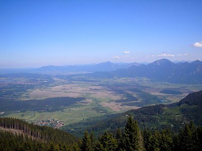
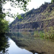
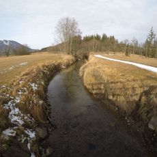
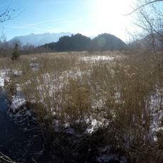
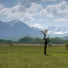
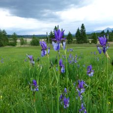
Murnauer Moos is a bog and fen area in the Bavarian pre-Alps, located southwest of Munich near the town of Murnau am Staffelsee. It combines fens, wet meadows, reed beds, and raised bog sections across a wide, flat basin surrounded by low hills and mountain views.

The area took shape after the last ice age, when meltwater settled in the lowlands and slowly gave rise to layers of peat over thousands of years. In the 20th century, drainage works and peat cutting reduced much of the wetland before legal protection was put in place.

The Murnauer Moos is one of the largest connected bog areas in Central Europe, something visitors notice as soon as they step onto the open terrain and see the horizon stretch unbroken in all directions. The walking paths are laid out so that people move through the landscape without disturbing the ground, keeping the experience close and direct.

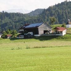
The reserve can be reached on foot from nearby villages, with marked trails starting from places like Murnau or Ohlstadt at the edges of the wetland. Spring and summer are good times to visit, when the ground is easier to walk and the wildlife more active.

Beneath the surface lies one of Bavaria's deepest peat layers, reaching down around 60 feet (18 meters) in places and holding ancient pollen, seeds, and wood fragments. Researchers use these layers to piece together how the local climate and plant life looked thousands of years ago.

The community of curious travelers

AroundUs brings together thousands of curated places, local tips, and hidden gems, enriched daily by 60,000 contributors worldwide.

Start exploring
Elevation above the sea
624 m
GPS coordinates
47.64800,11.15320
Latest update
March 3, 2026 08:21
Reviews
Share your experience

No review yet

Discussions
Start a discussion...

No discussion yet

« Murnauer Moos - Protected swamp in Garmisch-Partenkirchen, Germany » is provided by Around Us (aroundus.com). Images and texts are derived from Wikimedia project under a Creative Commons license. You are allowed to copy, distribute, and modify copies of this page, under the conditions set by the license, as long as this note is clearly visible.

Discover hidden gems everywhere you go!

From secret cafés to breathtaking viewpoints, skip the crowded tourist spots and find places that match your style. Our app makes it easy with voice search, smart filtering, route optimization, and insider tips from travelers worldwide. Download now for the complete mobile experience.

Around Us App Screenshot

A unique approach to discovering new places

Le Figaro

All the places worth exploring

France Info

A tailor-made excursion in just a few clicks

20 Minutes

Around Us
Travel Guide & Maps
Download

Send to your phone

QR Code
1

Open the camera app on your mobile.

2

Point at the QR code with your camera. A notification will appear.

3

Tap the notification to open the link.