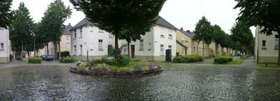
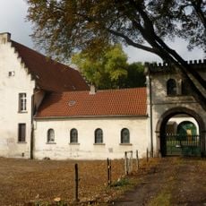
Siedlung Flöz Dickebank, Cultural heritage monument in Gelsenkirchen, Germany
Siedlung Flöz Dickebank is a residential complex in Gelsenkirchen with multiple houses, narrow gardens, and historic street lamps from the mining era. The settlement spreads across several streets including Virchowstrasse, Ulmenstrasse, and Flöz Sonnenschein, maintaining its original layout.
The settlement began in 1872 under the name Kolonie Ottilienau to house families of coal miners from the Holland, Alma, and Rheinelbe mines. Its expansion over several decades fundamentally shaped the neighborhood's development.
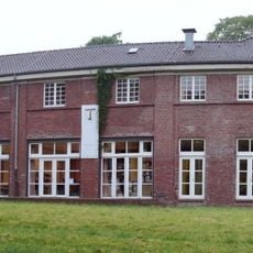
The housing development shows different building styles from various construction phases that are clearly visible as you walk through. The houses with their narrow gardens still define the neighborhood's character and reflect the working-class life of the Ruhr region.
The settlement is easily accessible on foot and can be explored at a leisurely pace. You can freely walk through the different streets and observe the historic buildings up close.
In the early 1970s, residents successfully opposed demolition plans and secured the settlement's survival. A community building was later established to serve as a gathering place for neighbors.
The community of curious travelers
AroundUs brings together thousands of curated places, local tips, and hidden gems, enriched daily by 60,000 contributors worldwide.