Enable Location

We need your location to show you interesting places around you

Discover nearby places

Find interesting locations and hidden gems around you

Precise directions

Get accurate directions and distances to places

Your location is never shared with other users. It's only used when you tap the location button.

Talsperre Dröda

Log in to your account

Start exploring — it's free

Trusted by 63,523 travelers worldwide

Continue with Google
Continue with Apple
or

We will send you a code to connect

By continuing, you accept our Terms and Conditions and our Privacy Policy

Check your inbox

We've sent a pincode in your inbox. Please enter the code below.

Talsperre Dröda
Discussion Reviews 1 Photos
2.1k Popularity

Talsperre Dröda, reservoir in Germany

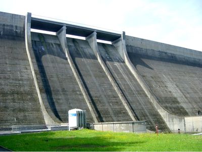
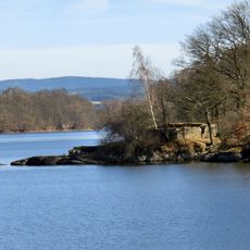
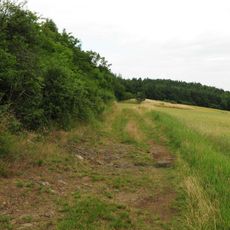
Talsperre Dröda is a large reservoir in the Vogtland region of Saxony built across two river systems to store water for surrounding communities. The concrete wall extends over 375 meters and rises more than 50 meters high, with water behind it forming two elongated basins whose shorelines vary from shallow areas with aquatic plants to steep drop-offs into deeper water.

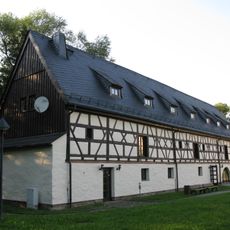
Construction of the reservoir began in 1964 and ended in 1971, with a concrete wall built to supply water to surrounding cities including Plauen, Oelsnitz, and Adorf plus approximately 35 additional communities. Completion of the dam marked a turning point in the region's water management and required the relocation of about 170 homes and farms along with the repositioning of roads and cemeteries.

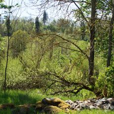
The name Dröda comes from local place names in the region. The water is used mainly by local residents for fishing, with activities adjusting to the seasons and shoreline areas frequented differently depending on weather conditions.

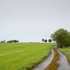
The area around the reservoir is accessible for walks on marked paths, with fishing allowed with proper permits. Swimming, boating, and camping are not permitted to protect water quality, and parking areas and information boards are available for visitors on site.

The reservoir supplies drinking water to more than 35 communities while simultaneously functioning as flood protection through controlled release of excess water. Additionally, a small power plant generates electricity, allowing the dam to contribute to local energy supply alongside its primary water management role.

The community of curious travelers

AroundUs brings together thousands of curated places, local tips, and hidden gems, enriched daily by 60,000 contributors worldwide.

Start exploring
Location
Location
Official opening
October 6, 1971
Elevation above the sea
435.5 m
GPS coordinates
50.39194,12.04528
Latest update
February 9, 2026 08:21
Reviews
Share your experience

No review yet

Discussions
Start a discussion...

No discussion yet

« Talsperre Dröda - reservoir in Germany » is provided by Around Us (aroundus.com). Images and texts are derived from Wikimedia project under a Creative Commons license. You are allowed to copy, distribute, and modify copies of this page, under the conditions set by the license, as long as this note is clearly visible.

Discover hidden gems everywhere you go!

From secret cafés to breathtaking viewpoints, skip the crowded tourist spots and find places that match your style. Our app makes it easy with voice search, smart filtering, route optimization, and insider tips from travelers worldwide. Download now for the complete mobile experience.

Around Us App Screenshot

A unique approach to discovering new places

Le Figaro

All the places worth exploring

France Info

A tailor-made excursion in just a few clicks

20 Minutes

Around Us
Travel Guide & Maps
Download

Send to your phone

QR Code
1

Open the camera app on your mobile.

2

Point at the QR code with your camera. A notification will appear.

3

Tap the notification to open the link.