Oelsnitz, Industrial city in Vogtlandkreis, Germany.
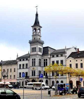
Oelsnitz is an industrial town in the Vogtlandkreis region of Saxony with residential neighborhoods, commercial zones, and administrative facilities. The town spreads across several districts in a gently sloped valley.
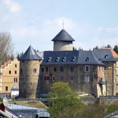
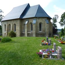
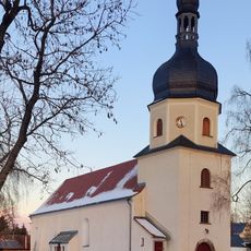
The town first gained city rights with a council in 1357, while Voigtsburg castle was built around 1200 by the regional administrators of Straßberg. These early structures laid the foundation for the settlement's growth.
The city coat of arms features a lion that recalls the Margraves of Meissen, while three stone balls symbolize the region's long mining tradition. These symbols shape how residents see their town today.
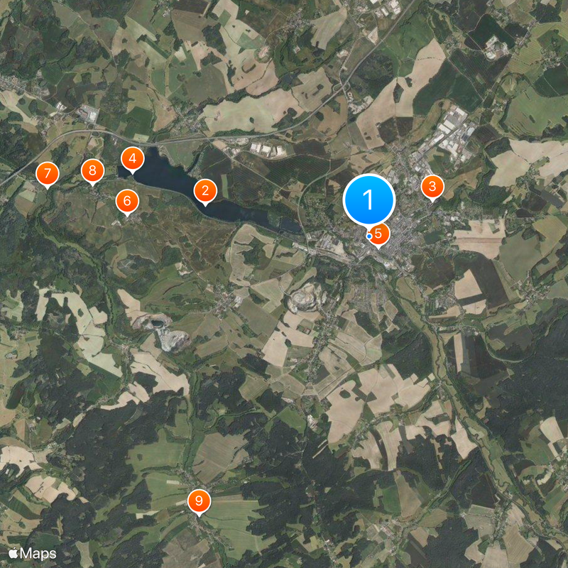
The town is connected to the region by several roads and has parking areas and public transport options for visitors. Walking or driving through the different districts helps you understand how the town is spread out and organized.
The town's council information system makes meeting documents and decisions available online, allowing residents to follow administrative decisions directly. This level of transparency was introduced quite early for a town of this size in eastern Germany.
Location: Vogtlandkreis
Elevation above the sea: 397 m
Shares border with: Triebel, Eichigt
Phone: +4937421730
Website: https://oelsnitz.de
GPS coordinates: 50.41667,12.16667
Latest update: December 20, 2025 11:26
Talsperre Pirk
3.2 km
Schloss Voigtsberg
1.4 km
Ruine Stein (Sachsen)
4.7 km
Saint James the Grater church in Oelsnitz/Vogtl.
279 m
Rittergut Planschwitz
4.7 km
Burg Türbel
6.3 km
Rittergut Magwitz
5.4 km
Wehrkirche Triebel
6.3 km
Town hall (Oelsnitz)
451 m
Kirche Taltitz
4.2 kmBurg Planschwitz
4.8 km
Freibad Elstergarten
787 mMietshaus in geschlossener Bebauung Karl-Liebknecht-Straße 55
534 mStadtscheune in geschlossener Bebauung Raschauer Straße 10
316 mGedenktafel an einem ehemaligen Wohnstallhaus eines Bauernhofes Stiftsweg 3
700 m
Schützenhaus Oelsnitz
536 m
Royal Saxon milestone Weischlitz
5.9 kmEinzeldenkmale der Sachgesamtheit Schloss Voigtsberg: Schlossanlage (ehemalige Burg, mehrere Gebäudeflügel und Turm), jetzt Museum und Archiv (siehe auch Einzeldenkmalliste - Obj. 09304752) Schloßstraße 32
1.4 kmTalsperre Pirk
4.3 kmRöhrholz
2.1 kmReste der Stadtmauer Grabenstraße -
253 mEhemalige Schule Hauptstraße 15
4.6 kmKirche (mit Ausstattung) sowie Kirchhof mit Einfriedung und Grabmalen Straße zum Ferienheim -
4.1 kmEhemalige Schule, jetzt Dorfgemeinschaftshaus Am Neunmühlental 1
3.3 kmEhemalige Fabrikantenvilla, mit Einfriedung und Garten Hofer Straße 4
739 mMietvilla mit Garten Hofer Straße 2
735 mBrunnen in Ecklage Feldstraße 9 (hinter)
549 mMietshaus in halboffener Bebauung Falkensteiner Straße 27
1 kmVisited this place? Tap the stars to rate it and share your experience / photos with the community! Try now! You can cancel it anytime.
Discover hidden gems everywhere you go!
From secret cafés to breathtaking viewpoints, skip the crowded tourist spots and find places that match your style. Our app makes it easy with voice search, smart filtering, route optimization, and insider tips from travelers worldwide. Download now for the complete mobile experience.
A unique approach to discovering new places❞
— Le Figaro
All the places worth exploring❞
— France Info
A tailor-made excursion in just a few clicks❞
— 20 Minutes