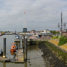
Semaphore in Cuxhaven, Maritime signal station in Cuxhaven, Germany.
The Semaphore in Cuxhaven stands at the Alte Liebe facing the Elbe estuary: a steel framework braced with wire cables, with two massive rear-supported masts about ten metres high carrying the wind-direction pointers for Borkum (left) and Helgoland (right). A cross-brace links them to a taller central mast bearing six pairs of indicator arms for wind speed, set by levers at ground level, with the letters B and H below.
The building was constructed in 1883 to warn ships approaching Cuxhaven harbor and convey information to them. It was one of the region's most important communication methods before radio technology transformed shipping.
The name comes from the Greek word sema, meaning sign, for a device that carries signs. The letters B and H on the middle mast stand for Borkum and Helgoland, the two islands whose wind is shown. Since 1982 the semaphore is out of official service but is still set by private initiative to current weather data, and a display board from the Cuxhaven city museum explains it.
The semaphore sits directly by Cuxhaven harbor and is easily reached on foot from the town center. Visitors should plan for good weather, as the structure stands in the open and is viewed from the outside.
The semaphore's coding was deliberately simple: each of the six arms per island either hung down or stood out at a right angle, marking wind strengths 2, 4, 6, 8, 10 and 12 on the Beaufort scale. The Prussian optical telegraph could show 4096 characters with half as many indicators, but this plain system was easier to read from the water.
The community of curious travelers
AroundUs brings together thousands of curated places, local tips, and hidden gems, enriched daily by 93,616 contributors worldwide.