Enable Location

We need your location to show you interesting places around you

Discover nearby places

Find interesting locations and hidden gems around you

Precise directions

Get accurate directions and distances to places

Your location is never shared with other users. It's only used when you tap the location button.

Tal der Langballigau

Log in to your account

Start exploring — it's free

Trusted by 61,320 travelers worldwide

Continue with Google
Continue with Apple
or

We will send you a code to connect

By continuing, you accept our Terms and Conditions and our Privacy Policy

Check your inbox

We've sent a pincode in your inbox. Please enter the code below.

Tal der Langballigau

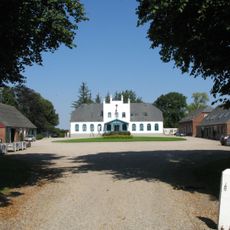
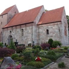
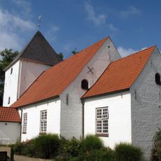
Tal der Langballigau, Protected area in Dollerup, Langballig, and Westerholz, Germany.

Description

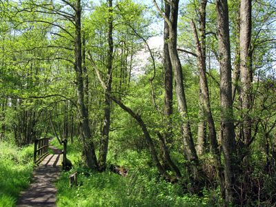
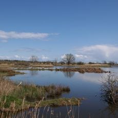
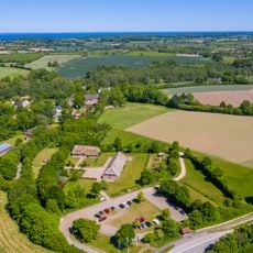
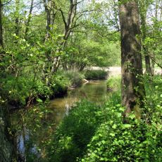
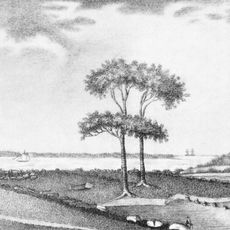
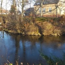
The Tal der Langballigau is a nature reserve featuring a deep stream valley where the Langballigau river winds through the landscape with its tributaries Schulau and Schiebek. The terrain combines open grasslands with wetland zones that shift with the seasons.

History

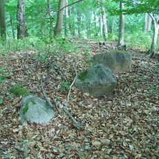
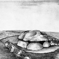
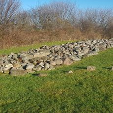
The protected area was officially established in 1990 and contains a large burial mound field documented by regional archaeological authorities. These findings reveal that the valley has been inhabited and used since prehistoric times.

Culture

Local land stewards use cattle grazing to manage the reed beds and maintain the natural wetland environment as it has been done for generations. You can observe this ongoing practice during your visit.

Practical

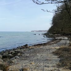
The reserve can be accessed via Kreisstraße 97 near Langballigholz at the point where the Langballigau flows into the Flensburger Förde inlet. Be prepared for wet and muddy ground in the lower valley sections, especially during wetter periods.

Did you know?

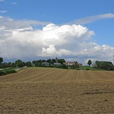
The northern section contains grasslands influenced by saltwater that experience periodic flooding in the lower valley areas. These unusual habitats form where the nearby inlet periodically reaches inland.

Location
Location
Location
Inception
1990
GPS coordinates
54.81083,9.66167
Latest update
December 14, 2025 16:43

AroundUs brings together thousands of curated places, local tips, and hidden gems, enriched daily by 60,000 contributors worldwide. Discover all places nearby (Dollerup).

« Tal der Langballigau - Protected area in Dollerup, Langballig, and Westerholz, Germany » is provided by Around Us (aroundus.com). Images and texts are derived from Wikimedia project under a Creative Commons license. You are allowed to copy, distribute, and modify copies of this page, under the conditions set by the license, as long as this note is clearly visible.

Discover hidden gems everywhere you go!

From secret cafés to breathtaking viewpoints, skip the crowded tourist spots and find places that match your style. Our app makes it easy with voice search, smart filtering, route optimization, and insider tips from travelers worldwide. Download now for the complete mobile experience.

Around Us App Screenshot

A unique approach to discovering new places

Le Figaro

All the places worth exploring

France Info

A tailor-made excursion in just a few clicks

20 Minutes

Around Us
Travel Guide & Maps
Download

Send to your phone

QR Code
1

Open the camera app on your mobile.

2

Point at the QR code with your camera. A notification will appear.

3

Tap the notification to open the link.