Mauzenstein, Natural monument sandstone rock in the northern Black Forest, Germany
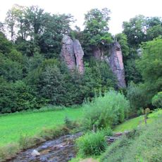
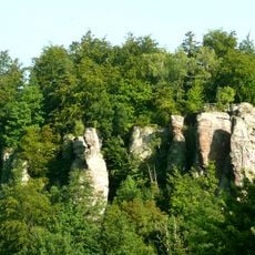
Mauzenstein is a Buntsandstein rock about 5 metres long on the Mauzenberg at 704.8 m, straddling the border between Gaggenau and Bad Herrenalb. It belongs to the upper pebble horizon (smc 2) of the Middle Buntsandstein, and the layering of the sedimentary rock is visible on its sides.
The rock once marked the boundary between Baden and Württemberg, and still bears carved markings from that period. It served as an important landmark for establishing borders in the region.
The rock carries cross-shaped markings cut into it when it served as a boundary stone on the Baden-Württemberg line. The Historische Grenzweg Michelbach–Moosbronn–Bernbach, a trail following that old border, passes directly by the block, and a sign explains the circular shapes on its top.
The rock is reachable from the village of Bernbach and involves a hike with moderate elevation changes. Sturdy shoes and a map or GPS device are recommended to navigate the route safely.
A sign at the rock reports that some local historians took the eroded circular marks on its top for traces of early astral worship. The Baden state geologist Walter Hasemann read them instead as large spheres in a sphere horizon of the Main Buntsandstein, like those on the nearby Bernsteinfelsen, and thus as natural concretions.
The community of curious travelers
AroundUs brings together thousands of curated places, local tips, and hidden gems, enriched daily by 92,638 contributors worldwide.