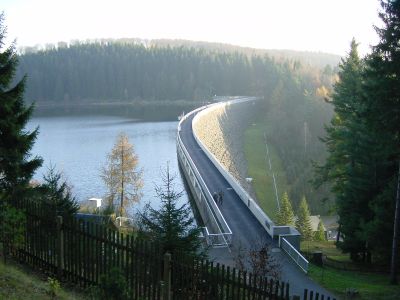
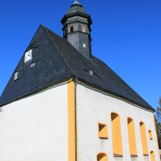
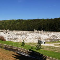
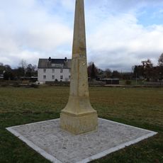
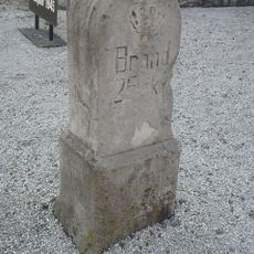
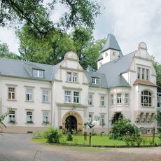
Saidenbach Dam, Cultural heritage dam in Pockau-Lengefeld, Germany.
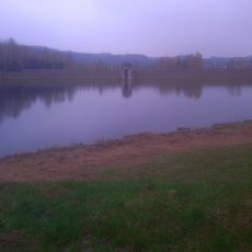
The Saidenbach Dam is a concrete barrier across a valley in the Erzgebirge region that creates a large body of water behind it. This water is used to supply cities with drinking water and to power small hydroelectric stations downstream.
Construction of this dam began in 1929 as a response to growing demands for drinking water and electricity in the nearby Saxony region. Once completed, it became an important part of the local water and energy infrastructure that shaped the region's development.
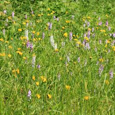
The dam serves as a gathering place where visitors walk trails that circle the reservoir and connect with the surrounding forests. Local communities have built their recreational activities around this water, making it a central feature of how people spend their leisure time.
The area around the dam is accessible by car and has walking paths of varying difficulty for different visitors. The best time to visit is during warmer months when the trails are in good condition and the surroundings are green.
Six different streams from the surrounding valleys feed water into this reservoir from various directions, making it a major collection point for the entire watershed. This network of tributaries keeps the water system balanced and ensures there is enough water for all its purposes throughout the year.
Location: Pockau-Lengefeld
Inception: 1929
Address: Lengefeld
GPS coordinates: 50.73294,13.21971
Latest update: December 8, 2025 19:49
Rauenstein Castle
1.4 km
Eliasburg
3.1 km
Adlerstein
5.5 km
Protestant Church
4.6 km
Dorfkirche Lippersdorf
3.9 km
Vorsperre Forchheim
4.1 km
Kgl.-sächs. Postmeilenstein Pockau
3.6 km
Kgl.-sächs. Postmeilenstein Lengefeld
2.5 km
Kgl.-sächs. Postmeilenstein in Wünschendorf
3.5 km
Kgl.-sächs. Postmeilenstein Reifland
808 m
Rittergut Niederforchheim
3.3 km
Haltepunkt Reifland-Wünschendorf
2 km
Kgl.-sächs. Postmeilenstein Rauenstein
1.7 km
Museum Kalkwerk Lengefeld
4.8 km
Talsperre Neunzehnhain I; Untere Neunzehnhainer Talsperre Wünschendorf
4 km
Station 87 Adlerstein
5.5 km
Rittergut Oberforchheim
3.3 km
Polish-Saxon Post Milestones in Reifland
798 m
Kgl.-sächs. Postmeilenstein Kalkwerk
4.8 km
Rathaus Börnichen/Erzgeb.
5.8 km
Börnichen church
5.7 km
Kalkwerk Lengefeld
4.9 km
Ehemalige Mühle, davor Brücke Neunzehnhainer Straße 14
4.7 km
Kirche und Friedhof Börnichen (Sachgesamtheit) Dorfstraße 45
5.7 km
Kalkwerk Lengefeld (Sachgesamtheit) Kalkwerk
4.9 km
Sachgesamtheit Rittergut Lippersdorf mit folgenden Einzeldenkmalen: ehemaliges Herrenhaus (Jagdschloss, später Erholungsheim), Wirtschaftsgebäude (ehemals Remise und Stall), Torbogen (zwischen Herrenhaus und Wirtschaftsgebäude) und Gartenpavillon
3.6 km
Wohnhaus Rathausstraße 10
5.7 km
Zwei Schulgebäude Rathausstraße 7; 8
5.7 kmVisited this place? Tap the stars to rate it and share your experience / photos with the community! Try now! You can cancel it anytime.
Discover hidden gems everywhere you go!
From secret cafés to breathtaking viewpoints, skip the crowded tourist spots and find places that match your style. Our app makes it easy with voice search, smart filtering, route optimization, and insider tips from travelers worldwide. Download now for the complete mobile experience.
A unique approach to discovering new places❞
— Le Figaro
All the places worth exploring❞
— France Info
A tailor-made excursion in just a few clicks❞
— 20 Minutes