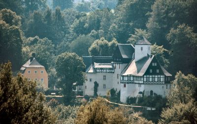
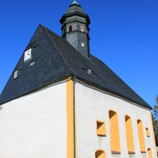
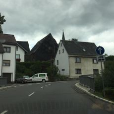
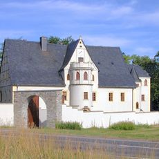
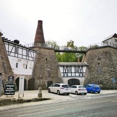
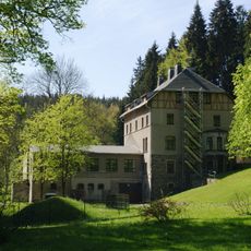
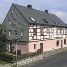
Rauenstein Castle, Medieval castle in Pockau-Lengefeld, Germany
Rauenstein Castle is a fortified structure in Pockau-Lengefeld sitting at 420 meters elevation above the Flöha River with solid defensive works. The eastern section contains a 40-meter tunnel that was constructed within the complex during major renovations.
The castle was first recorded in 1323 under the Schellenberg knights before passing to the Electorate of Saxony in 1567. This transfer marked a turning point in how the fortress was governed and used.
The von Herder family, descendants of theologian Johann Gottfried von Herder, shaped the castle from 1843 onward with their vision and stewardship. Visitors today can sense their influence in how the spaces are arranged and maintained throughout the grounds.
The grounds are open for visitors to explore the fortifications and tunnel passages on their own. Sturdy footwear is recommended since the terrain has slopes and uneven surfaces throughout the complex.
Visitors often miss that the 40-meter tunnel served as a practical passageway between different areas rather than purely a defensive feature. Its construction during renovations in the 1600s reveals how the fortress adapted to changing needs over time.
Location: Pockau-Lengefeld
GPS coordinates: 50.72900,13.20100
Latest update: December 8, 2025 19:47
Lauterbacher Knochen
4.9 km
Saidenbach Dam
1.4 km
Eliasburg
2.7 km
Adlerstein
4.3 km
Dorfkirche Lippersdorf
5.2 km
Vorsperre Forchheim
5.4 km
Kgl.-sächs. Postmeilenstein Lengefeld
1.3 km
Kgl.-sächs. Postmeilenstein Pockau
3.7 km
Kgl.-sächs. Postmeilenstein in Wünschendorf
2.5 km
Kgl.-sächs. Postmeilenstein Rauenstein
500 m
Kgl.-sächs. Postmeilenstein Reifland
1.2 km
Rittergut Niederforchheim
4.5 km
Haltepunkt Reifland-Wünschendorf
1.4 km
Museum Kalkwerk Lengefeld
3.7 km
Rittergut Oberforchheim
4.6 km
Station 87 Adlerstein
4.3 km
Kalkwerk Lengefeld
3.8 km
Talsperre Neunzehnhain I; Untere Neunzehnhainer Talsperre Wünschendorf
2.7 km
Polish-Saxon Post Milestones in Reifland
1.1 km
Station 86 Lauterbacher Knochen
4.9 km
Rathaus Börnichen/Erzgeb.
4.7 km
Börnichen church
4.7 km
Kgl.-sächs. Postmeilenstein Kalkwerk
3.6 km
Ehemalige Mühle, davor Brücke Neunzehnhainer Straße 14
3.3 km
Kirche und Friedhof Börnichen (Sachgesamtheit) Dorfstraße 45
4.7 km
Kalkwerk Lengefeld (Sachgesamtheit) Kalkwerk
3.7 km
Sachgesamtheit Rittergut Lippersdorf mit folgenden Einzeldenkmalen: ehemaliges Herrenhaus (Jagdschloss, später Erholungsheim), Wirtschaftsgebäude (ehemals Remise und Stall), Torbogen (zwischen Herrenhaus und Wirtschaftsgebäude) und Gartenpavillon
4.9 km
Wohnhaus Rathausstraße 10
4.7 kmVisited this place? Tap the stars to rate it and share your experience / photos with the community! Try now! You can cancel it anytime.
Discover hidden gems everywhere you go!
From secret cafés to breathtaking viewpoints, skip the crowded tourist spots and find places that match your style. Our app makes it easy with voice search, smart filtering, route optimization, and insider tips from travelers worldwide. Download now for the complete mobile experience.
A unique approach to discovering new places❞
— Le Figaro
All the places worth exploring❞
— France Info
A tailor-made excursion in just a few clicks❞
— 20 Minutes