Enable Location

We need your location to show you interesting places around you

Discover nearby places

Find interesting locations and hidden gems around you

Precise directions

Get accurate directions and distances to places

Your location is never shared with other users. It's only used when you tap the location button.

Lauterbacher Knochen

Log in to your account

Start exploring — it's free

Trusted by 64,502 travelers worldwide

Continue with Google
Continue with Apple
or

We will send you a code to connect

By continuing, you accept our Terms and Conditions and our Privacy Policy

Check your inbox

We've sent a pincode in your inbox. Please enter the code below.

Lauterbacher Knochen
Discussion Reviews 1 Photos
8.8k Popularity

Lauterbacher Knochen, Mountain summit in Marienberg, Germany.

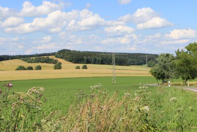
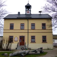
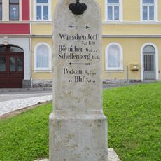
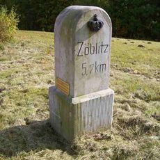
Lauterbacher Knochen is a mountain summit in the Ore Mountains, close to the town of Marienberg in Saxony. It sits on the watershed between the Zschopau and Flöha river valleys and is reached by a network of hiking trails.

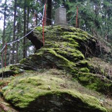
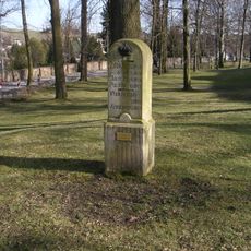
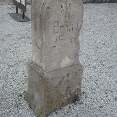
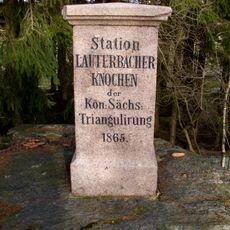
In the 19th century, the summit was included in the Royal Saxon Triangulation Network, a system used to map the territory of Saxony with precision. A measurement station was placed there as part of that broader surveying effort.

The summit is a gathering place for hikers who explore the natural landscape and enjoy the panoramic views throughout the seasons. Visitors often use it as a waypoint during longer walks through the mountain region.

The summit can be reached by several hiking trails that suit different fitness levels. The top is often exposed to wind and changing weather, so sturdy shoes and an extra layer of clothing are worth bringing along.

On a clear day, several other summits in the Ore Mountains are visible from the top, including Poehlberg, Fichtelberg, and Keilberg. This makes the peak a useful point of orientation within the wider mountain range.

The community of curious travelers

AroundUs brings together thousands of curated places, local tips, and hidden gems, enriched daily by 60,000 contributors worldwide.

Start exploring
Location
Elevation above the sea
683 m
GPS coordinates
50.69066,13.16654
Latest update
March 3, 2026 08:19
Reviews
Share your experience

No review yet

Discussions
Start a discussion...

No discussion yet

« Lauterbacher Knochen - Mountain summit in Marienberg, Germany » is provided by Around Us (aroundus.com). Images and texts are derived from Wikimedia project under a Creative Commons license. You are allowed to copy, distribute, and modify copies of this page, under the conditions set by the license, as long as this note is clearly visible.

Discover hidden gems everywhere you go!

From secret cafés to breathtaking viewpoints, skip the crowded tourist spots and find places that match your style. Our app makes it easy with voice search, smart filtering, route optimization, and insider tips from travelers worldwide. Download now for the complete mobile experience.

Around Us App Screenshot

A unique approach to discovering new places

Le Figaro

All the places worth exploring

France Info

A tailor-made excursion in just a few clicks

20 Minutes

Around Us
Travel Guide & Maps
Download

Send to your phone

QR Code
1

Open the camera app on your mobile.

2

Point at the QR code with your camera. A notification will appear.

3

Tap the notification to open the link.