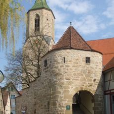
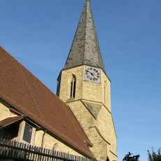
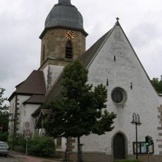
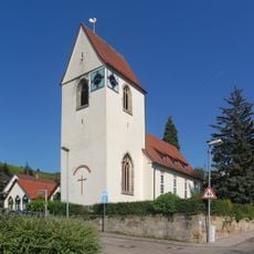
Dionysiuskirche, Protestant church in Grunbach, Germany
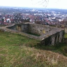
Dionysiuskirche is a church building in Grunbach with an octagonal tower and late Gothic elements. The choir is crowned by a ribbed vault ceiling, while the church is surrounded by a ring wall with support pillars.
The building was erected in 1481 on the foundation of an earlier structure from the 11th century. In 1863, the church received Gothic modifications by architect Christian Friedrich von Leins.
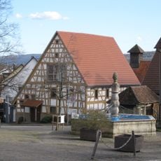
The church displays craftsmanship from local artisans, including works by regional sculptors and glassmakers that reflect the artistic traditions of the area. These pieces show how religious spaces served as places where skilled makers could present their best work to the community.
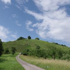
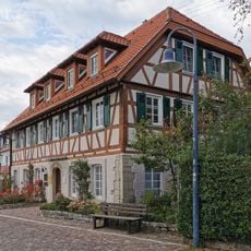
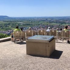
The church is easily accessible from the outside and invites exploration of its architecture and interior features. The ring wall surrounds the grounds and provides space to explore and photograph the building from different angles.
Inside sits a Romanesque baptismal font from 1200, one of the oldest fixtures in the building. Modern windows by Wolf-Dieter Kohler and Hans Gottfried von Stockhausen show how contemporary artists gave the church new meaning in later times.
Location: Remshalden
Inception: 1481
GPS coordinates: 48.81932,9.41796
Latest update: December 12, 2025 17:48
Burg Beutelsbach
2.2 km
Buocher Höhe
2 km
Stiftskirche Beutelsbach
2.7 km
Schloss Großheppach
2 km
Württemberg-Haus
2.7 km
Evangelische Kirche
1.7 km
Aegidiuskirche
2.2 km
Konradskirche
2 km
Zipfelbachtal, Korber Kopf, Buocher Höhe, Remstalhänge, Ramsbachtal und Grafenberg
1.6 km
Aegidiuskirche
2.2 km
Rathaus Remshalden
1.7 km
Talabschnitt der Rems zwischen Weinstadt und Remshalden samt Fuß des Kappelberges
1.5 km
Kreuzkirche
3.1 km
Museum im Hirsch
1.6 km
St. Michael
1.2 km
Museum Remshalden - Heimat Wirtschaft Heinkel
201 m
Neuapostolische Kirche Remshalden-Geradstetten
2.1 km
Eiche und Buche
1.6 km
Remstalkino-Beutelsbach
2.4 km
Ehemaliger Steinbruch im unteren Stubensandstein
1 km
Waldstück auf dem Kleinheppacher Kopf
3.1 km
Quelle m.Kalksinterbildung u.anschließender Klinge
1.2 km
Gehölz mit Steppenheide und sog. Steinfelsen
502 m
Dorfteich mit Baumbestand
1.5 km
Linde
1.6 km
Eibe
2.7 km
Alter Steinbruch mit Gehölzen u.Trockenrasen
2.3 km
Alte Steinbruchwände und Flurgehölze
3.2 kmVisited this place? Tap the stars to rate it and share your experience / photos with the community! Try now! You can cancel it anytime.
Discover hidden gems everywhere you go!
From secret cafés to breathtaking viewpoints, skip the crowded tourist spots and find places that match your style. Our app makes it easy with voice search, smart filtering, route optimization, and insider tips from travelers worldwide. Download now for the complete mobile experience.
A unique approach to discovering new places❞
— Le Figaro
All the places worth exploring❞
— France Info
A tailor-made excursion in just a few clicks❞
— 20 Minutes