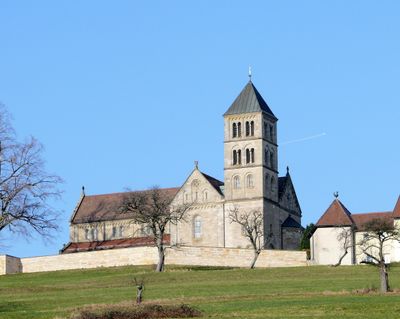
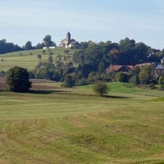
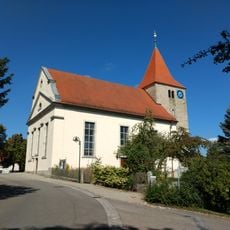
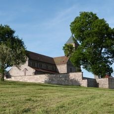
St. Jakobus, Church building in Rosenberg, Germany
St. Jakobus is a church building on Hohenberg hill featuring 17 high windows, six side aisle windows, and two large transept windows with a rose window. The interior contains religious artworks and maintains spaces for both worship and special gatherings.
The church appears in documents from 1332 and 1489, showing its role as a center of religious life in the area. These early records, including indulgence letters, show how long people valued this place.
The interior houses an altarpiece created by Sieger Köder, an artist who also served as parish priest here and filled the space with his own religious works during his time.
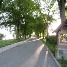
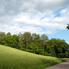
The church holds regular services and has space for concerts, while also serving as a stop on a pilgrimage route from Würzburg. Its location on the hilltop makes it a natural place to visit while exploring the area.
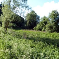
A Lourdes grotto built into the northern slope contains glass particles from the local glass factory, blending industrial heritage with this sacred place. A Stations of the Cross path, consecrated in 1883, guides visitors through the landscape.
Location: Rosenberg
GPS coordinates: 49.00284,10.03908
Latest update: December 12, 2025 17:42
Schloss Adelmannsfelden
5.8 km
Fischbachsee
6.1 km
Hohenberg
175 m
Virngrund und Ellwanger Berge
5.4 km
Speicherbecken Orrot
3.5 km
Orbachtal mit Streuwiesen
1.3 km
Evangelische Kirche
5.8 km
Oberes Blinde Rot-Tal
3.5 km
Rotenbachtal - Sekretärweiher
5.4 km
Hohenberg
120 m
Pflanzenstandort bei Dietrichsweiler
4.6 km
Jagsttal zwischen Ellwangen-Rindelbach u. d. Kreisgrenze nördlich v. Jagstzell mit angrenzenden Gebieten
5 km
Hohlweg beim Kellerhof
5.4 km
Jagstaltwasser zwischen Kalkhöfe u.Schweighausen
5.1 km
2 Eichen bei der Ölmühle
5.8 km
Oberes Blinde Rot-Tal
4.6 km
Feldrain westlich Randenweiler
6.3 km
1 Eckarroter Linde
5.9 km
1 Linde bei Dietrichsweiler
4.8 km
Altwasser der Jagst zw.Kalkhöfe u.Schweighausen
5.5 km
Feuchtgebiet bei Eckarrot
5.9 km
1 Linde oberhalb der Rosenberger Str.
5.1 km
1 Eiche im Schliff
6.3 km
1 Eiche nahe der Kreisgrenze
6.5 km
1 Linde auf dem Hohenberg
132 m
Eichenwald bei Rindelbach
6.2 km
Feuchtgebiet bei der Marienkapelle
4.8 km
Treibsee
4.3 kmVisited this place? Tap the stars to rate it and share your experience / photos with the community! Try now! You can cancel it anytime.
Discover hidden gems everywhere you go!
From secret cafés to breathtaking viewpoints, skip the crowded tourist spots and find places that match your style. Our app makes it easy with voice search, smart filtering, route optimization, and insider tips from travelers worldwide. Download now for the complete mobile experience.
A unique approach to discovering new places❞
— Le Figaro
All the places worth exploring❞
— France Info
A tailor-made excursion in just a few clicks❞
— 20 Minutes