Chest opened
+${chestReward.xp} XP
Explorer
NOUVEAU ×${chestReward.collectible.quantity}
tapez pour fermer

See the monuments around you in AR Open chests in the app

Around Us is built for your phone — point your camera at the streets and discover the monuments and places around you in augmented reality. Around Us is built for your phone — chests unlock when you walk, explore and capture nearby places.

•

Enable Location

We need your location to show you interesting places around you

Discover nearby places

Find interesting locations and hidden gems around you

Precise directions

Get accurate directions and distances to places

Your location is never shared with other users. It's only used when you tap the location button.

Staustufe Wintrich

Log in to your account

Start exploring — it's free

Trusted by 93,760 travelers worldwide

Continue with Google
Continue with Apple
or

We will send you a code to connect

By continuing, you accept our Terms and Conditions and our Privacy Policy

Check your inbox

We've sent a pincode in your inbox. Please enter the code below.

Staustufe Wintrich

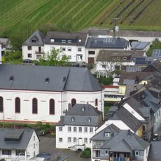
Staustufe Wintrich, Lock and barrage in Wintrich, Germany

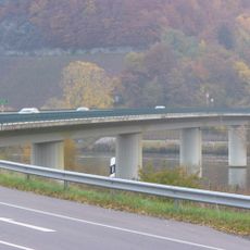
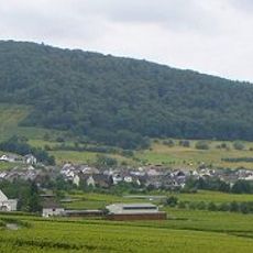
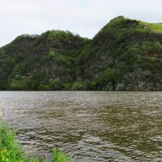
Staustufe Wintrich is a lock and barrage complex on the Moselle River that manages water flow and enables navigation for commercial vessels. The facility combines a lock chamber, dam structure, and power generation infrastructure in a single installation.

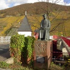
The Moselle was canalised into a regulated waterway between 1958 and 1964, and Wintrich became its 8th of 12 barrages, at river kilometre 141.4. Before that, the Wintricher Furt, a shoal with rapids and river islands between km 140.8 and 141.5, forced ships to be towed by 20 to 25 horses, often with helpers from Kesten. A sandstone relief of Saint Nicholas, patron of boatmen, was donated around 1600 at the Nikolausfels above the upper end of the ford.

The barrage serves as the eighth of twelve water control points on the main 242-kilometer stretch between Koblenz and Apach.

The lock chamber is 172 m long and 12 m wide; single vessels up to 110 m (135 m with special permission) are admitted, and push convoys up to 172.10 m. A passage takes about 19 minutes upstream and 15 minutes downstream. The lock is closed roughly 11 days a year for high water and repairs.

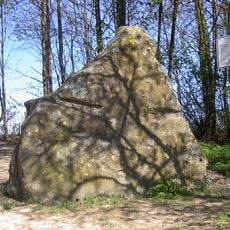
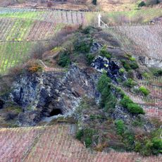
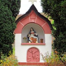
At river kilometre 141.2, high in a vertical rock face beside the lower harbour, a sandstone relief of Saint Nicholas of Myra, patron saint of boatmen, was donated around 1600 by a Moselle skipper. It recalls the Wintricher Furt, a dangerous shoal where 20 to 25 horses from Kesten once hauled unpowered barges upstream.

The community of curious travelers

AroundUs brings together thousands of curated places, local tips, and hidden gems, enriched daily by 93,760 contributors worldwide.

Start exploring
Location
GPS coordinates
49.87967,6.94806
Latest update
October 25, 2026 16:26
Reviews
Share your experience

No review yet

Discussions
Start a discussion...

No discussion yet

« Staustufe Wintrich - Lock and barrage in Wintrich, Germany » is provided by Around Us (aroundus.com). Images and texts are derived from Wikimedia project under a Creative Commons license. You are allowed to copy, distribute, and modify copies of this page, under the conditions set by the license, as long as this note is clearly visible.

Discover hidden gems everywhere you go!

From secret cafés to breathtaking viewpoints, skip the crowded tourist spots and find places that match your style. Our app makes it easy with voice search, smart filtering, route optimization, and insider tips from travelers worldwide. Download now for the complete mobile experience.
Around Us App Screenshot
❝

A unique approach to discovering new places❞

— Le Figaro

❝

All the places worth exploring❞

— France Info

❝

A tailor-made excursion in just a few clicks❞

— 20 Minutes

Around Us
Travel Guide & Maps
Download

Send to your phone

QR Code
1

Open the camera app on your mobile.

2

Point at the QR code with your camera. A notification will appear.

3

Tap the notification to open the link.