Landwehr, Promontory fort in Brohl-Lützing, Germany
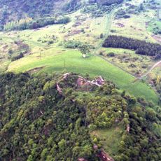
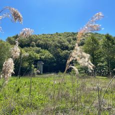
The Landwehr near Brohl-Lützing is an Iron Age promontory fort on a high plateau above the left bank of the Rhine, bounded by the Brohlbach stream and the river. It consists of two parallel earthen ramparts 75 metres apart in the Eichels district, each fronted by a ditch facing south. No prehistoric buildings have been found there.
The site is an Iron Age section rampart, possibly dating to the 6th century BC. It consists of two parallel ramparts 75 metres apart in the Eichels district, each with a ditch in front, both facing south; no prehistoric buildings have been found. Paul Steiner of the Trier provincial museum classified it in 1932 as a simple section rampart, doubled by a second one.
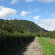
The site is listed as a natural monument in Brohl-Lützing; the cited source is an article by Rektor Rausch of Ahrweiler in the 1954 Heimatjahrbuch of the Ahrweiler district, which mentions a Celtic ring fortification on the Diktberg near Brohl. The two ramparts and their south-facing ditches lie in the Eichels district, reached today by a field path that becomes a narrow footpath down to Brohl-Lützing.
The remains are accessible via marked trails near Brohl-Lützing, with parking available at the base of the ridge. Access is free and the site is easy to explore on foot.
The elevation of Landwehr offers viewpoints with wide vistas across the valley and surrounding landscape. Such distant visibility was of great strategic value to the ancient fort for controlling the region.
The community of curious travelers
AroundUs brings together thousands of curated places, local tips, and hidden gems, enriched daily by 93,839 contributors worldwide.