
LSG-Waldgebiet Westerwald zwischen Aa und Saatgauer Bach
LSG-Waldgebiet Westerwald zwischen Aa und Saatgauer Bach, protected area in Germany
Location: Ostbevern
Inception: 2011
GPS coordinates: 52.07257,7.82801
Latest update: March 6, 2025 22:20
Schloss Loburg
4.8 km
Haus Langen
7.7 km
Haus Bevern
4.4 km
St. Ambrosius
4.1 km
Kloster Rengering
7.3 km
Klatenberge
8.1 km
Anna-Kapelle
3.6 km
St. Georg Ostbevern
3.6 km
Halstenbeck
6.1 km
Heimathaus
3.8 km
Pietàkapelle
4.1 km
Johannes-Kirche
3.8 km
Herz-Jesu-Kirche
3.6 km
Gemeindezentrum der Christlichen Gemeinde Ostbevern
3.2 km
Hagelprozession Marienkapelle
3.1 km
Brinkjans Krüüs
3.6 km
Rochuskapelle (Ostbevern)
4.1 km
Christuskirche
4 km
Nepomukstatue
7.3 km
Kapelle zur schmerzhaften Mutter
3.8 km
Schirlheide
8.8 km
Donatusstatue
3.8 km
Alte Beverwiese
7.9 km
Sieben-Schmerzen-Madonna
7 km
Gereonkapelle
6.7 km
St. Marien
7.2 km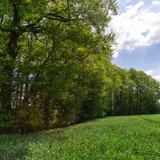
Stupperige Baumgosse
8.1 km
Landschaftsschutzgebiet Dünengebiet Klatenberge
8.5 kmReviews
Visited this place? Tap the stars to rate it and share your experience / photos with the community! Try now! You can cancel it anytime.
Discover hidden gems everywhere you go!
From secret cafés to breathtaking viewpoints, skip the crowded tourist spots and find places that match your style. Our app makes it easy with voice search, smart filtering, route optimization, and insider tips from travelers worldwide. Download now for the complete mobile experience.

A unique approach to discovering new places❞
— Le Figaro
All the places worth exploring❞
— France Info
A tailor-made excursion in just a few clicks❞
— 20 Minutes