Enable Location

We need your location to show you interesting places around you

Discover nearby places

Find interesting locations and hidden gems around you

Precise directions

Get accurate directions and distances to places

Your location is never shared with other users. It's only used when you tap the location button.

Raschplatzhochstraße

Log in to your account

Start exploring — it's free

Trusted by 61,455 travelers worldwide

Continue with Google
Continue with Apple
or

We will send you a code to connect

By continuing, you accept our Terms and Conditions and our Privacy Policy

Check your inbox

We've sent a pincode in your inbox. Please enter the code below.

Raschplatzhochstraße

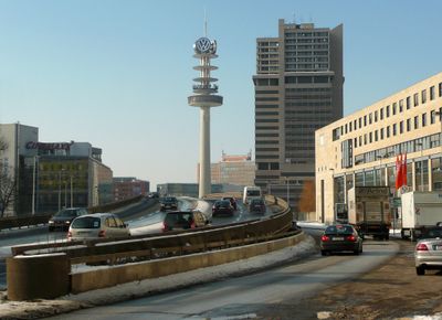
Raschplatzhochstraße, Elevated road and bridge in Mitte district, Hanover, Germany.

Description

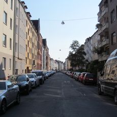
Raschplatzhochstraße is an elevated road and bridge in Mitte district, Hanover, that spans multiple streets and enables continuous traffic flow above ground level. The structure connects Hamburger Allee with Berliner Allee, carrying vehicles over intersections and urban thoroughfares.

History

The elevated roadway was built in 1970 as a response to growing traffic in central Hanover. Construction changed the urban landscape and separated different traffic levels to speed the flow of vehicles through the center.

Culture

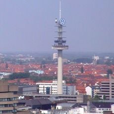
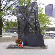
The name refers to nearby Raschplatz, a central urban junction named after a former mayor. The space beneath the elevated roadway hosts Festival Theaterformen, which presents international productions and experimental performances.

Practical

The elevated roadway is open to traffic around the clock and offers drivers a direct route through the city center. Pedestrians reach the areas below via stairs and pathways that lead to streets at ground level.

Did you know?

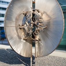
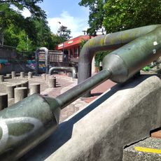
Beneath the elevated roadway stands the sculpture Hangover by Andreas von Weizsäcker, which adds an artistic note to the concrete pillars. The work was installed during the late 20th century and plays with the visual weight of the infrastructure above.

Location
GPS coordinates
52.37910,9.74420
Latest update
December 20, 2025 11:44

AroundUs brings together thousands of curated places, local tips, and hidden gems, enriched daily by 60,000 contributors worldwide. Discover all places nearby (Mitte).

« Raschplatzhochstraße - Elevated road and bridge in Mitte district, Hanover, Germany » is provided by Around Us (aroundus.com). Images and texts are derived from Wikimedia project under a Creative Commons license. You are allowed to copy, distribute, and modify copies of this page, under the conditions set by the license, as long as this note is clearly visible.

Discover hidden gems everywhere you go!

From secret cafés to breathtaking viewpoints, skip the crowded tourist spots and find places that match your style. Our app makes it easy with voice search, smart filtering, route optimization, and insider tips from travelers worldwide. Download now for the complete mobile experience.

Around Us App Screenshot

A unique approach to discovering new places

Le Figaro

All the places worth exploring

France Info

A tailor-made excursion in just a few clicks

20 Minutes

Around Us
Travel Guide & Maps
Download

Send to your phone

QR Code
1

Open the camera app on your mobile.

2

Point at the QR code with your camera. A notification will appear.

3

Tap the notification to open the link.