Port of Kos, Maritime transport hub in Kos, Greece
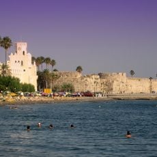
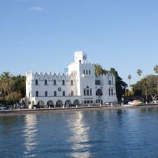
The Port of Kos, called Mandraki, lies at the northeastern tip of the island. Its inner basin is a stone- and concrete-walled polygon about 330 m long and 250 m wide, reached through a funnel-shaped entrance roughly 70 m wide. Palm-lined quays around it are open to pedestrians and cyclists, while outer moles handle large ferries and cruise ships.
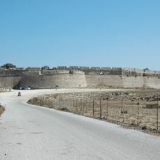
The Knights of Saint John, who ruled Kos from 1315 to 1522, fortified the port with the fortress of Neratzia to control shipping between the island and the Anatolian mainland. After the 1933 earthquake, the Italian occupation authorities redesigned the harbour surroundings. Today the port serves mainly regional passenger and freight traffic.
The harbour is also called Mandraki, a name shared with the harbour of Nisyros, about 16.5 km away. Fishermen sell their fresh catch and other seafood directly at the berths. The inner basin's quay walls are planted with palms and open to pedestrians and cyclists.
The port area is easy to reach on foot from the town center, with clear signage along the waterfront promenade. It is best to visit during daytime hours when ferry operations are active and passenger facilities are fully open.
The inner basin covers about 9 hectares within a perimeter of roughly 1.6 kilometres, entered through a funnel-shaped channel about 90 metres wide at its widest and 70 metres at the built opening. Ferries berth stern-to at the entrance, so the passage narrows whenever a large ship is unloading. A pier in front of the Neratzia fortress, used for cargo, can carry heavy lorries.
The community of curious travelers
AroundUs brings together thousands of curated places, local tips, and hidden gems, enriched daily by 94,451 contributors worldwide.