Enable Location

We need your location to show you interesting places around you

Discover nearby places

Find interesting locations and hidden gems around you

Precise directions

Get accurate directions and distances to places

Your location is never shared with other users. It's only used when you tap the location button.

Reichshoffen

Log in to your account

Start exploring — it's free

Trusted by 62,481 travelers worldwide

Continue with Google
Continue with Apple
or

We will send you a code to connect

By continuing, you accept our Terms and Conditions and our Privacy Policy

Check your inbox

We've sent a pincode in your inbox. Please enter the code below.

Reichshoffen, Administrative commune in Bas-Rhin, France

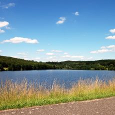
Reichshoffen is a commune in the Alsatian region, set between elevations of 170 and 301 meters, surrounded by wooded valleys in northeastern France. The terrain offers a varied landscape with green spaces and natural features that shape the community's character.

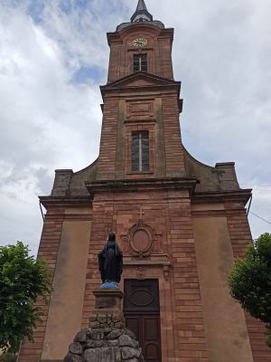
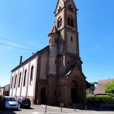
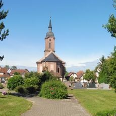
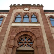
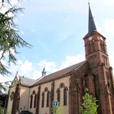
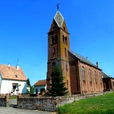
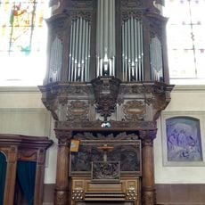
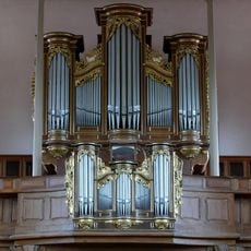
The Saint-Michel Church was built in 1772 and stands as a witness to the architectural development of that era. The structure marks a period of design and modernization in the settlement that remains visible today.

The community has maintained strong ties with nearby German towns for decades, hosting regular meetings and exchange programs that reflect the region's cross-border connections.

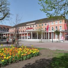
A weekly market takes place every Thursday in the town center, where local products from the Bas-Rhin region are available. Visitors can find fresh goods and purchase local specialties directly from producers.

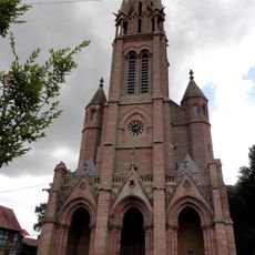
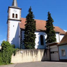
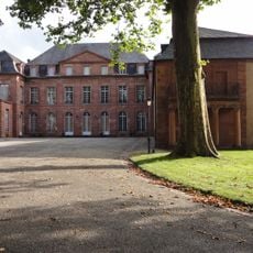
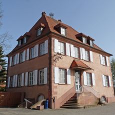
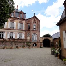
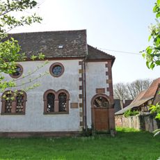
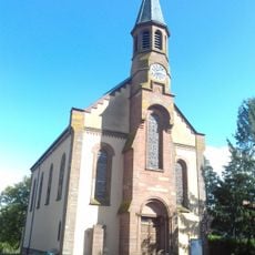
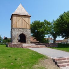
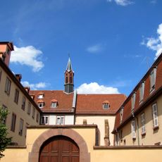
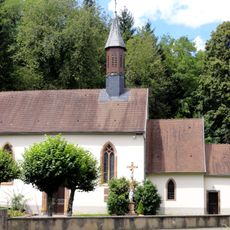
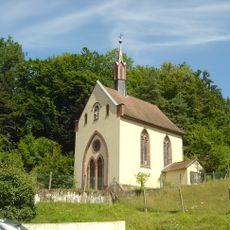
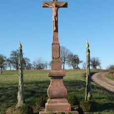
The area holds historical traces from different periods, visible in local customs and architectural landmarks. These layers tell of migrations and new beginnings that shaped the place's identity.

The community of curious travelers

AroundUs brings together thousands of curated places, local tips, and hidden gems, enriched daily by 60,000 contributors worldwide.

Start exploring
Location
Unterelsaß
Location
Inception
November 1, 1972
Industry
administration publique générale
Shares border with
Frœschwiller, Gumbrechtshoffen, Gundershoffen, Langensoultzbach, Niederbronn-les-Bains, Oberbronn, Windstein
Address
67110 Reichshoffen, France
Phone
GPS coordinates
48.93444,7.66611
Latest update
December 7, 2025 20:43
Around this place
Église de la Paix de Frœschwiller
France

Église de la Paix de Frœschwiller

4.2 km
Église protestante de Gundershoffen
France

Église protestante de Gundershoffen

3.1 km
Château de Dietrich
France

Château de Dietrich

504 m
Casino of Niederbronn-les-Bains
France

Casino of Niederbronn-les-Bains

2.5 km
Église Saint-Jacques-le-Majeur de Gundershoffen
France

Église Saint-Jacques-le-Majeur de Gundershoffen

3.2 km
Musée du fer de Reichshoffen
France

Musée du fer de Reichshoffen

299 m
Château de Frœschwiller
France

Château de Frœschwiller

4.1 km
Église Saint-Michel de Reichshoffen
France

Église Saint-Michel de Reichshoffen

308 m
Ancienne synagogue de Reichshoffen
France

Ancienne synagogue de Reichshoffen

439 m
House of Archaeology
France

House of Archaeology

1.8 km
Église Saint-Wendelin d'Eberbach
France

Église Saint-Wendelin d'Eberbach

4.4 km
Ancienne synagogue de Niederbronn-les-Bains
France

Ancienne synagogue de Niederbronn-les-Bains

2.3 km
Ancienne église dite Altkirch
France

Ancienne église dite Altkirch

435 m
Réserve naturelle régionale du plan d'eau de Reichshoffen
France

Réserve naturelle régionale du plan d'eau de Reichshoffen

1.9 km
Ancienne usine d'électricité de Niederbronn-les-Bains
France

Ancienne usine d'électricité de Niederbronn-les-Bains

1.7 km
Banc-reposoir de Frœschwiller
France

Banc-reposoir de Frœschwiller

3.4 km
Église Saint-Martin de Niederbronn-les-Bains
France

Église Saint-Martin de Niederbronn-les-Bains

2.2 km
Couvent de Niederbronn-les-Bains
France

Couvent de Niederbronn-les-Bains

2.3 km
Chapelle Notre-Dame-du-Bon-Secours de Reichshoffen
France

Chapelle Notre-Dame-du-Bon-Secours de Reichshoffen

1.1 km
Église Saint-Jean de Niederbronn-les-Bains
France

Église Saint-Jean de Niederbronn-les-Bains

2.5 km
Église du Sacré-Cœur-de-Jésus de Nehwiller
France

Église du Sacré-Cœur-de-Jésus de Nehwiller

4.2 km
Niederbronn-les-Bains German War Cemetery
France

Niederbronn-les-Bains German War Cemetery

1.6 km
Temple protestant de Nehwiller
France

Temple protestant de Nehwiller

4 km
Grande chapelle du couvent du Très-Saint-Sauveur d'Oberbronn
France

Grande chapelle du couvent du Très-Saint-Sauveur d'Oberbronn

4.2 km
Orgue de chœur à Reichshoffen
France

Orgue de chœur à Reichshoffen

308 m
Orgue de tribune de l'église Saint-Michel de Reichshoffen
France

Orgue de tribune de l'église Saint-Michel de Reichshoffen

308 m
Chapelle Notre-Dame-de-l'Immaculée-Conception de Windstein
France

Chapelle Notre-Dame-de-l'Immaculée-Conception de Windstein

4.8 km
Croix de chemin à Eberbach-Woerth
France

Croix de chemin à Eberbach-Woerth

4 km
Show the full map
« Reichshoffen - Administrative commune in Bas-Rhin, France » is provided by Around Us (aroundus.com). Images and texts are derived from Wikimedia project under a Creative Commons license. You are allowed to copy, distribute, and modify copies of this page, under the conditions set by the license, as long as this note is clearly visible.

Discover hidden gems everywhere you go!

From secret cafés to breathtaking viewpoints, skip the crowded tourist spots and find places that match your style. Our app makes it easy with voice search, smart filtering, route optimization, and insider tips from travelers worldwide. Download now for the complete mobile experience.

Around Us App Screenshot

A unique approach to discovering new places

Le Figaro

All the places worth exploring

France Info

A tailor-made excursion in just a few clicks

20 Minutes

Around Us
Travel Guide & Maps
Download

Send to your phone

QR Code
1

Open the camera app on your mobile.

2

Point at the QR code with your camera. A notification will appear.

3

Tap the notification to open the link.