Bouxwiller

Log in to your account

AroundUs is a community-driven map of interesting places, built by curious explorers like you. It grows with every review, story, and photo you share.
Connect to save your favorite spots, contribute locations, and create personalized routes.
By continuing, you accept our Terms and Conditions and our Privacy Policy
Add to collection
Map
Suggest a change
Share

Bouxwiller, Medieval commune in Bas-Rhin, France

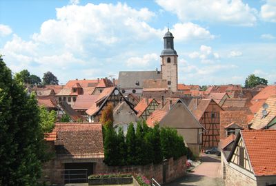
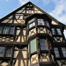
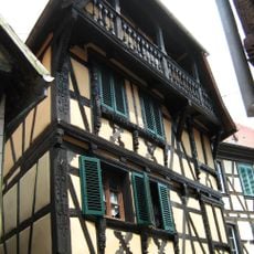
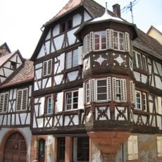
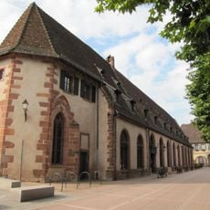
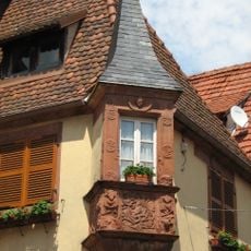
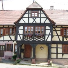
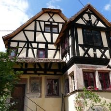
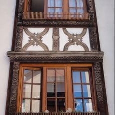
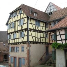
Bouxwiller is a commune in Bas-Rhin in northeastern France, nestled in a wooded valley with traditional architecture scattered throughout. The town center features half-timbered houses and narrow streets that preserve its medieval layout.

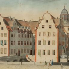
The settlement first appeared in records in 724 and later became the seat of the Counts of Hanau-Lichtenberg from around 1300 onward. It remained an important administrative center until the county's end in 1736.

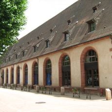
The former synagogue from 1844 now houses the Judeo-Alsatian Museum, which documents the local Jewish community that lived here for centuries. The collection tells stories of families and traditions that shaped the town's social life.

The former railway line between this town and Saverne has been converted into a cycling path for easy exploration of the surrounding region. Artisanal shops are housed in the old railway station building, which serves as a local activity hub.

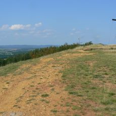
Excavations on Bastberg Hill uncovered Roman bath ruins, revealing that the area was inhabited since ancient times. These discoveries show that the town's history extends back much further than its medieval period.

Location: Bas-Rhin

Location: Communauté de communes de Hanau-La Petite Pierre

Location: arrondissement of Saverne

Inception: March 1, 1973

Elevation above the sea: 227 m

Shares border with: Obersoultzbach, Bosselshausen, Dossenheim-sur-Zinsel, Hattmatt, Kirrwiller, Neuwiller-lès-Saverne, Niedersoultzbach, Obermodern-Zutzendorf, Printzheim, Uttwiller, Weiterswiller, Geiswiller-Zœbersdorf

Phone: +33388707016

Email: mairie@bouxwiller.eu

Website: https://bouxwiller.eu

GPS coordinates: 48.82528,7.48278

Latest update: December 7, 2025 20:45

Photos
Reviews

Visited this place? Tap the stars to rate it and share your experience / photos with the community! Try now! You can cancel it anytime.

« Bouxwiller - Medieval commune in Bas-Rhin, France » is provided by Around Us (aroundus.com). Images and texts are derived from Wikimedia project under a Creative Commons license. You are allowed to copy, distribute, and modify copies of this page, under the conditions set by the license, as long as this note is clearly visible.

Discover hidden gems everywhere you go!

From secret cafés to breathtaking viewpoints, skip the crowded tourist spots and find places that match your style. Our app makes it easy with voice search, smart filtering, route optimization, and insider tips from travelers worldwide. Download now for the complete mobile experience.

Around Us App Screenshot

A unique approach to discovering new places

Le Figaro

All the places worth exploring

France Info

A tailor-made excursion in just a few clicks

20 Minutes