Enable Location

We need your location to show you interesting places around you

Discover nearby places

Find interesting locations and hidden gems around you

Precise directions

Get accurate directions and distances to places

Your location is never shared with other users. It's only used when you tap the location button.

Ambert

Log in to your account

Start exploring — it's free

Trusted by 62,407 travelers worldwide

Continue with Google
Continue with Apple
or

We will send you a code to connect

By continuing, you accept our Terms and Conditions and our Privacy Policy

Check your inbox

We've sent a pincode in your inbox. Please enter the code below.

Ambert, Administrative center in Puy-de-Dôme, France

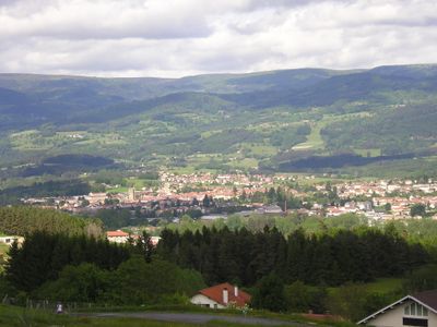
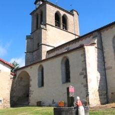
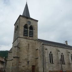
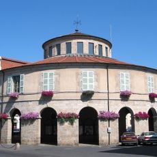
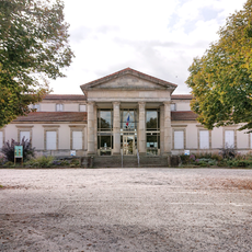
Ambert is an administrative center in Puy-de-Dôme in the Auvergne region, situated on the banks of the Dore River. Located at 514 meters elevation, it serves as a regional hub with a town hall, tourist information office, and municipal services.

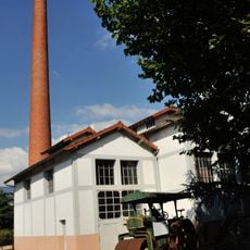
The town served as an important paper production center in the 18th century, manufacturing high-quality materials for printing books. This papermaking tradition shaped the region's economic development for generations.

The town's name comes from the Latin word "ambitus," meaning surroundings. Cheese culture shapes daily life here, with local shops and restaurants centering their menus around the famous Fourme d'Ambert blue cheese.

The town is easy to explore on foot, with the town hall and tourist information office located on Boulevard Henri IV. Visitors can find guidance easily and get information about local sites and activities from staff there.

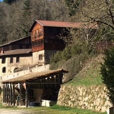
The Richard de Bas paper mill still demonstrates traditional manufacturing techniques used for centuries in the town. Visitors can watch craftspeople produce paper by hand and see how printing materials were made in earlier times.

The community of curious travelers

AroundUs brings together thousands of curated places, local tips, and hidden gems, enriched daily by 60,000 contributors worldwide.

Start exploring
Location
Elevation above the sea
680 m
Shares border with
Bertignat, La Forie, Grandrif, Job, Marsac-en-Livradois, Le Monestier, Saint-Ferréol-des-Côtes, Saint-Martin-des-Olmes, Thiolières, Valcivières
Phone
GPS coordinates
45.54944,3.74167
Latest update
December 17, 2025 10:18
« Ambert - Administrative center in Puy-de-Dôme, France » is provided by Around Us (aroundus.com). Images and texts are derived from Wikimedia project under a Creative Commons license. You are allowed to copy, distribute, and modify copies of this page, under the conditions set by the license, as long as this note is clearly visible.

Discover hidden gems everywhere you go!

From secret cafés to breathtaking viewpoints, skip the crowded tourist spots and find places that match your style. Our app makes it easy with voice search, smart filtering, route optimization, and insider tips from travelers worldwide. Download now for the complete mobile experience.

Around Us App Screenshot

A unique approach to discovering new places

Le Figaro

All the places worth exploring

France Info

A tailor-made excursion in just a few clicks

20 Minutes

Around Us
Travel Guide & Maps
Download

Send to your phone

QR Code
1

Open the camera app on your mobile.

2

Point at the QR code with your camera. A notification will appear.

3

Tap the notification to open the link.