Enable Location

We need your location to show you interesting places around you

Discover nearby places

Find interesting locations and hidden gems around you

Precise directions

Get accurate directions and distances to places

Your location is never shared with other users. It's only used when you tap the location button.

Nogent-le-Rotrou

Log in to your account

Start exploring — it's free

Trusted by 62,441 travelers worldwide

Continue with Google
Continue with Apple
or

We will send you a code to connect

By continuing, you accept our Terms and Conditions and our Privacy Policy

Check your inbox

We've sent a pincode in your inbox. Please enter the code below.

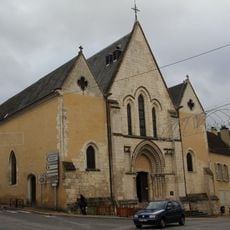
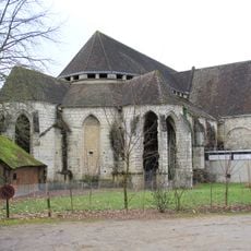
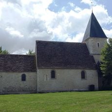
Nogent-le-Rotrou, Medieval commune in Eure-et-Loir, France.

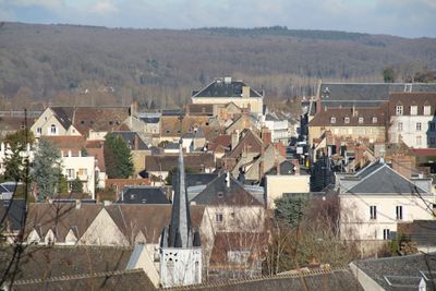
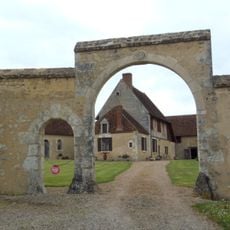
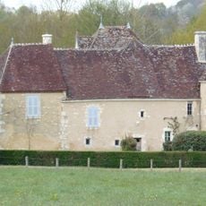
Nogent-le-Rotrou sits in north-central France within the Eure-et-Loir department and serves as the administrative seat of an arrondissement covering 48 communes. The town spreads along the Huisne River valley, with gentle hills and wooded areas forming its natural setting.

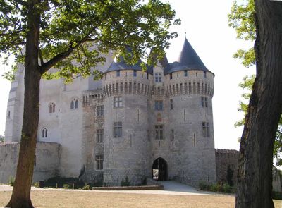
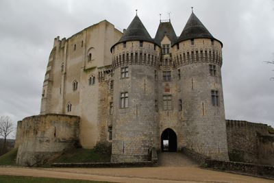
The settlement began during Roman times under the name Novigentum and grew into an important trading center during the Middle Ages. The arrondissement was dissolved in 1926 and restored in 1943, with the town maintaining its administrative role throughout these changes.

The municipal library organizes regular reading workshops and educational programs, while the town maintains several annual festivals celebrating local traditions.

The town can be reached via regional roads that connect it to larger centers in the Centre-Val de Loire region. Visitors can explore the historic center on foot, as most points of interest lie within walking distance of each other.

The town name derives from the Celtic word for new combined with a Latin suffix indicating a settlement. Despite the interruption in the 20th century, the town remained a continuous center for surrounding rural communes throughout the period.

The community of curious travelers

AroundUs brings together thousands of curated places, local tips, and hidden gems, enriched daily by 60,000 contributors worldwide.

Start exploring
Location
Location
canton de Nogent-le-Rotrou
Elevation above the sea
135 m
Shares border with
Trizay-Coutretot-Saint-Serge, Berd'huis, Saint-Hilaire-sur-Erre, Saint-Pierre-la-Bruyère, Arcisses, Perche en Nocé, Val-au-Perche, Sablons-sur-Huisne
Address
28400 Nogent-le-Rotrou, France
Phone
GPS coordinates
48.32167,0.82167
Latest update
December 14, 2025 17:31
« Nogent-le-Rotrou - Medieval commune in Eure-et-Loir, France » is provided by Around Us (aroundus.com). Images and texts are derived from Wikimedia project under a Creative Commons license. You are allowed to copy, distribute, and modify copies of this page, under the conditions set by the license, as long as this note is clearly visible.

Discover hidden gems everywhere you go!

From secret cafés to breathtaking viewpoints, skip the crowded tourist spots and find places that match your style. Our app makes it easy with voice search, smart filtering, route optimization, and insider tips from travelers worldwide. Download now for the complete mobile experience.

Around Us App Screenshot

A unique approach to discovering new places

Le Figaro

All the places worth exploring

France Info

A tailor-made excursion in just a few clicks

20 Minutes

Around Us
Travel Guide & Maps
Download

Send to your phone

QR Code
1

Open the camera app on your mobile.

2

Point at the QR code with your camera. A notification will appear.

3

Tap the notification to open the link.