Port-Saint-Louis-du-Rhône, Port commune in Bouches-du-Rhône, France.
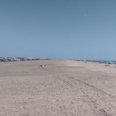
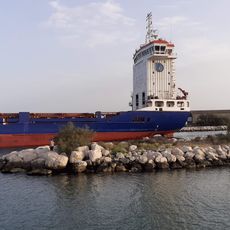
Port-Saint-Louis-du-Rhône covers 173 square kilometers at the mouth of the Grand Rhône River, providing direct access to the Mediterranean Sea with developed port facilities and Napoleon beach extending over 10 kilometers along the coast.
The commune was officially established in 1904 from parts of Arles and Fos-sur-Mer, with its development facilitated by the digging of the Saint-Louis channel in 1871 that improved navigation and maritime transport connections.
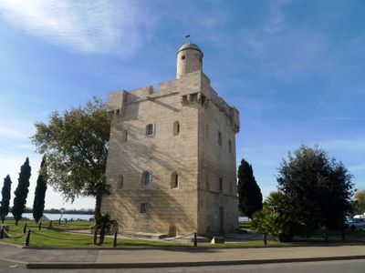
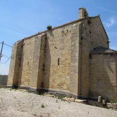
Local architecture reflects traditional Camargue style with rustic construction materials suited to surrounding marshlands, while the 18th-century Saint Louis Tower now houses the tourist office and displays a collection of 168 naturalized birds.
A weekly market takes place every Wednesday and Saturday morning downtown, offering fresh seafood, Provencal produce, and regional specialties for both residents and visitors to enjoy.
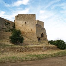
The Favouillane sheepfold dates back to the early 19th century and remains one of the region's largest traditional sheepfolds, still inhabited by a shepherd and his flock today.
Location: Bouches-du-Rhône
Location: arrondissement of Istres
Location: canton of Arles
Location: Métropole Aix-Marseille-Provence
Elevation above the sea: 1 m
Shares border with: Arles, Fos-sur-Mer
Address: Port-Saint-Louis-du-Rhône, France
Phone: +33442869000
Email: courrier@portsaintlouis.fr
Website: http://portsaintlouis.fr
GPS coordinates: 43.38750,4.80444
Latest update: September 29, 2025 13:14
Viaduc de Martigues
19.3 km
Pont de Caronte
17.9 km
Oppidum de Saint-Blaise
16.6 km
Réserve naturelle nationale des marais du Vigueirat
17.1 km
Château de Fos-sur-Mer
12.8 km
Plage de Piémanson
4.7 km
Phare du fort de Bouc
14.7 km
Tour Saint-Louis
351 m
Église Notre-Dame-de-Beauvoir
20.4 km
Porte d'Arles
20.5 km
Réserve naturelle régionale de la Tour du Valat
17.4 km
Phare de Saint Gervais
11.9 km
Fort de Bouc
14.7 km
Église Saint Sauveur de Fos-sur-Mer
12.8 km
Plage des Laurons
18.1 km
PLage Olga
4 km
Plage naturiste de Bonnieu
18.1 km
Chapelle Notre-Dame-de-la-Mer
12.5 km
Chapelle Saint-Blaise
16.7 km
Chapelle Saint Michel à Saint-Mitre-les-Remparts
18.3 km
Plage de l'Ours
14.1 km
Zone naturiste de la plage de Piémanson
4.8 km
Église de la Nativité-de-la-Vierge du Sambuc
16.7 km
Town hall of Fos-sur-Mer
13.5 km
City walls of Fos-sur-Mer
10.9 km
Enceinte de Saint-Mitre-les-Remparts
18.4 km
Entrepôts maritimes de la Compagnie générale de navigation
196 m
Reviews
Visited this place? Tap the stars to rate it and share your experience / photos with the community! Try now! You can cancel it anytime.
Discover hidden gems everywhere you go!
From secret cafés to breathtaking viewpoints, skip the crowded tourist spots and find places that match your style. Our app makes it easy with voice search, smart filtering, route optimization, and insider tips from travelers worldwide. Download now for the complete mobile experience.
A unique approach to discovering new places❞
— Le Figaro
All the places worth exploring❞
— France Info
A tailor-made excursion in just a few clicks❞
— 20 Minutes