·

Enable Location

We need your location to show you interesting places around you

Discover nearby places

Find interesting locations and hidden gems around you

Precise directions

Get accurate directions and distances to places

Your location is never shared with other users. It's only used when you tap the location button.

Les Lilas

Log in to your account

Start exploring — it's free

Trusted by 62,647 travelers worldwide

Continue with Google
Continue with Apple
or

We will send you a code to connect

By continuing, you accept our Terms and Conditions and our Privacy Policy

Check your inbox

We've sent a pincode in your inbox. Please enter the code below.

Les Lilas, Administrative commune in Seine-Saint-Denis, France.

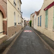
Les Lilas is a commune in northeastern Paris within the Île-de-France region, characterized by residential neighborhoods and dense urban development. The territory blends older housing stock with modern apartment blocks throughout its area.

The commune was formed in 1867 from parts of neighboring Romainville, Pantin, and Bagnolet, establishing its administrative independence. This territorial division shaped its boundaries and spatial structure that remain today.

The name comes from the lilac trees that once filled the private gardens throughout the area. Today, street names and the municipal coat of arms still echo this botanical heritage.

The Mairie-des-Lilas metro station on Line 11 provides direct connections to central Paris and makes arriving easy. Visitors should plan time to explore the residential neighborhoods on foot and note that the main town hall is located on Rue de Paris.

Singer Serge Gainsbourg immortalized the Porte des Lilas station in his 1958 song 'Le Poinçonneur des Lilas' about a metro ticket puncher. The song became a musical portrait of everyday working life at the station.

The community of curious travelers

AroundUs brings together thousands of curated places, local tips, and hidden gems, enriched daily by 60,000 contributors worldwide.

Start exploring
Location
Inception
July 24, 1867
Elevation above the sea
119 m
Shares border with
Paris, 19th arrondissement of Paris, Le Pré-Saint-Gervais, Pantin, Romainville, Bagnolet
Phone
GPS coordinates
48.88000,2.41694
Latest update
December 14, 2025 18:47
« Les Lilas - Administrative commune in Seine-Saint-Denis, France » is provided by Around Us (aroundus.com). Images and texts are derived from Wikimedia project under a Creative Commons license. You are allowed to copy, distribute, and modify copies of this page, under the conditions set by the license, as long as this note is clearly visible.

Discover hidden gems everywhere you go!

From secret cafés to breathtaking viewpoints, skip the crowded tourist spots and find places that match your style. Our app makes it easy with voice search, smart filtering, route optimization, and insider tips from travelers worldwide. Download now for the complete mobile experience.

Around Us App Screenshot

A unique approach to discovering new places

Le Figaro

All the places worth exploring

France Info

A tailor-made excursion in just a few clicks

20 Minutes

Around Us
Travel Guide & Maps
Download

Send to your phone

QR Code
1

Open the camera app on your mobile.

2

Point at the QR code with your camera. A notification will appear.

3

Tap the notification to open the link.