Île de Ré

Log in to your account

AroundUs is a community-driven map of interesting places, built by curious explorers like you. It grows with every review, story, and photo you share.
Connect to save your favorite spots, contribute locations, and create personalized routes.
Continue with Google
Continue with Apple
Continue with X
Continue with Facebook
Continue with email
By continuing, you accept our Terms and Conditions and our Privacy Policy
Create an account

Île de Ré

Add to collection
Map
Suggest a change
Share

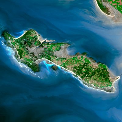
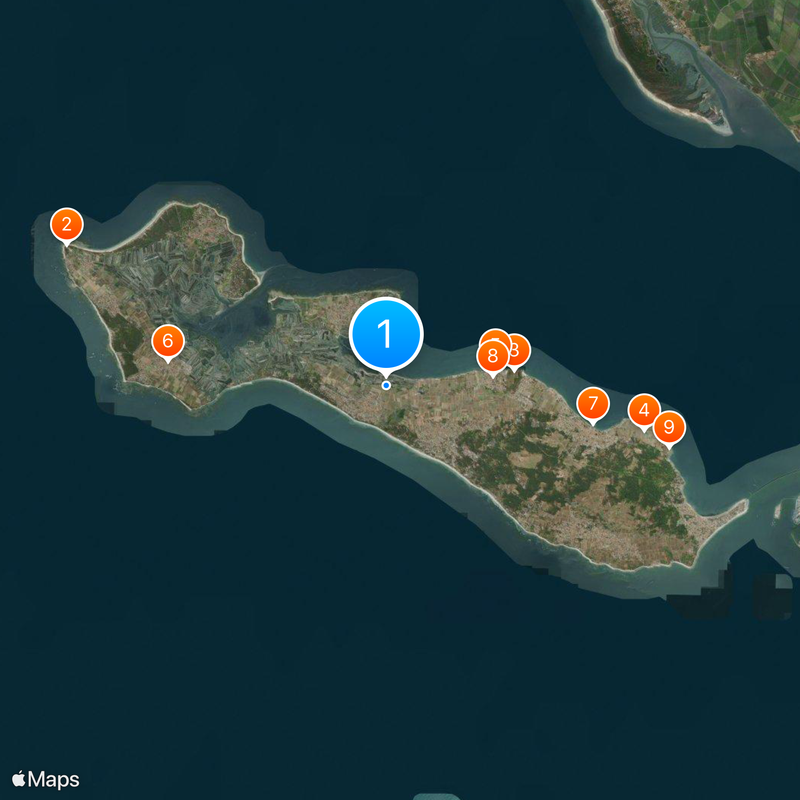
Île de Ré, Atlantic island in Charente-Maritime, France.

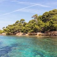
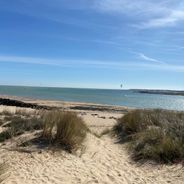
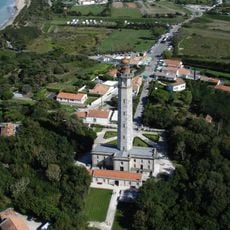
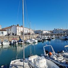
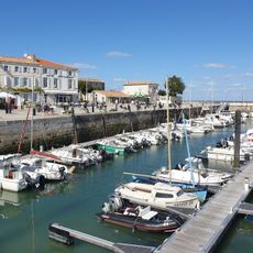
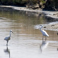
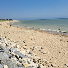
Île de Ré is an Atlantic island off the coast of Charente-Maritime, stretching about 30 kilometers (19 miles) and connected to the mainland by a bridge. Ten small villages sit scattered among sandy beaches, salt ponds, and low pine woods that mark the flat terrain.

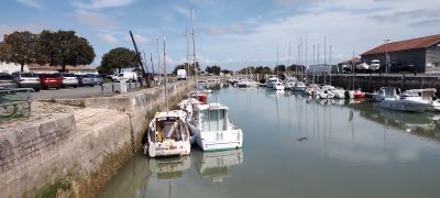
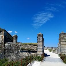
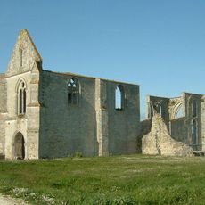
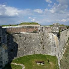
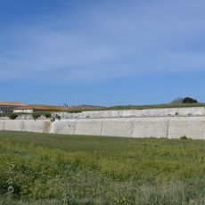
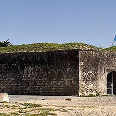
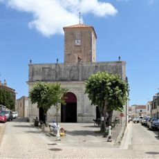
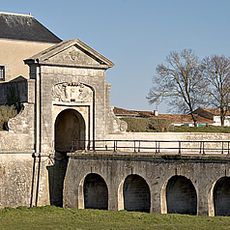
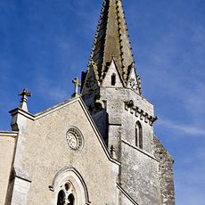
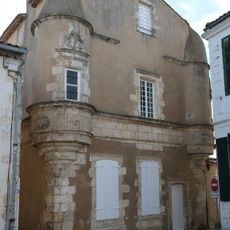
The island belonged to English holdings in France during medieval times before becoming French in the 17th century. Vauban built the fortress at Saint-Martin-de-Ré to defend the harbor from attacks by sea.

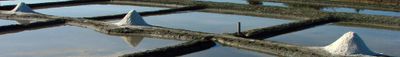
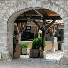
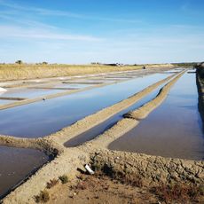
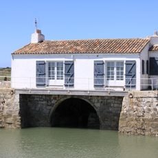
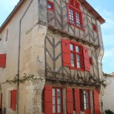
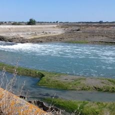
Salt harvesters still work the marshes using wooden tools unchanged for generations, raking crystals by hand under the summer sun. The white walls and green shutters seen across the island follow a building style that reflects coastal light and keeps interiors cool during warm months.

A network of over 100 kilometers (62 miles) of cycling paths links all the villages, often running beside salt marshes and beaches. Most routes are flat and easy for families with children, especially outside peak summer months.

Poitou donkeys wear striped trousers on their legs to protect them from bites while hauling loads through the damp salt flats. The animals were once used to carry barrels of salt and now serve as a symbol of the island.

Location: Ars-en-Ré

Location: Le Bois-Plage-en-Ré

Location: La Couarde-sur-Mer

Location: La Flotte

Location: Loix

Location: Les Portes-en-Ré

Location: Rivedoux-Plage

Location: Saint-Clément-des-Baleines

Location: Saint-Martin-de-Ré

Location: Sainte-Marie-de-Ré

Capital city: Saint-Martin-de-Ré

Elevation above the sea: 20 m

Part of: archipel charentais

Address: Île de Ré, France

Website: http://iledere.com

GPS coordinates: 46.20000,-1.41667

Latest update: December 17, 2025 01:42

Photos
Things to do in La Rochelle and its surroundings with family

La Rochelle and its surroundings offer families a range of activities along the French Atlantic coast. The city itself holds several attractions, including the aquarium with over 12,000 marine animals, medieval towers at the Old Port, and various museums such as the Maritime Museum and the New World...

Secret Corners of the Island of Ré

The Île de Ré reveals preserved sites beyond its main destinations. The salt marshes of Loix and the Lilleau des Niges Nature Reserve host more than 300 species of migratory birds, while the Baleines Lighthouse offers a view of the Atlantic Ocean. Beaches such as Trousse Chemise and Les Grenettes...

Reviews

Visited this place? Tap the stars to rate it and share your experience / photos with the community! Try now! You can cancel it anytime.

« Île de Ré - Atlantic island in Charente-Maritime, France » is provided by Around Us (aroundus.com). Images and texts are derived from Wikimedia project under a Creative Commons license. You are allowed to copy, distribute, and modify copies of this page, under the conditions set by the license, as long as this note is clearly visible.

Discover hidden gems everywhere you go!

From secret cafés to breathtaking viewpoints, skip the crowded tourist spots and find places that match your style. Our app makes it easy with voice search, smart filtering, route optimization, and insider tips from travelers worldwide. Download now for the complete mobile experience.

Around Us App Screenshot

A unique approach to discovering new places

Le Figaro

All the places worth exploring

France Info

A tailor-made excursion in just a few clicks

20 Minutes