La Réole, Medieval commune in Nouvelle-Aquitaine, France
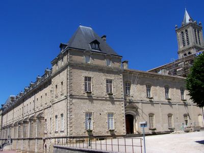
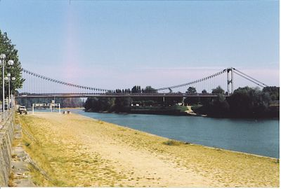
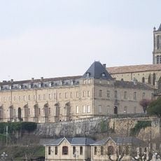
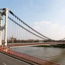
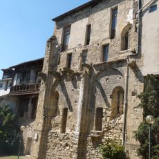
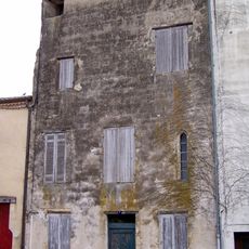
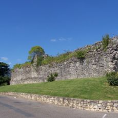
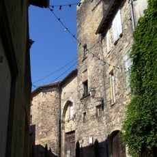
La Réole sits on the right bank of the Garonne River and features narrow medieval streets with stone buildings that follow the old street patterns. The town developed around a Benedictine monastery, whose presence shaped how the buildings and pathways are arranged.
A monastery founded between the 7th and 8th centuries became the core of the settlement, giving the place its name derived from the Latin word Regula. The location on the Garonne River then made it grow into a significant religious and trading center.
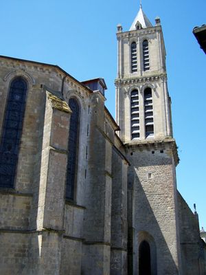
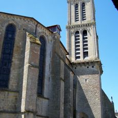
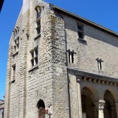
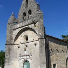
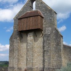
The Saint-Pierre church displays 12th-century romanesque features that reflect the town's deep religious roots. Walking through the old streets, you can see how monastic life shaped the layout and character of the place.
The town is accessible by train with connections to major regional cities. Walking through the old streets and along the river offers good views of the medieval layout and the surrounding countryside.
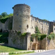
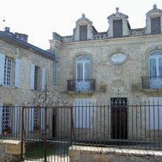
The Château de Quat'Sos displays construction styles from two different periods because both King Louis VIII and King Henry II of England left their mark on it. This blend of styles makes the building a witness to the medieval power struggles in the region.
Location: canton of La Réole
Location: Gironde
Location: Comunautat de comunas deu Reulés en Sud Gironda
Location: arrondissement of Langon
Inception: 977
Elevation above the sea: 56 m
Shares border with: Saint-Sève, Floudès, Bagas, Bourdelles, Les Esseintes, Fontet, Gironde-sur-Dropt, Montagoudin, Saint-Hilaire-de-la-Noaille
Address: 33190 La Réole, France
Phone: +33556611011
Email: mairie@lareole.fr
Website: http://lareole.fr
GPS coordinates: 44.58107,-0.04122
Latest update: December 20, 2025 11:42
Château des Quat'Sos
171 m
Prieuré de La Réole
14 m
Église Saint-Pierre de La Réole
40 m
Rouergue bridge
621 m
Ancien hôtel de ville de La Réole
248 m
Maisons médiévales de La Réole
282 m
Maison Ézemar
3.4 km
Maison Seguin de La Réole
194 m
Enceinte de La Réole
617 m
Église Saint-Front de Fontet
2.3 km
Hôtel de Briet
356 m
Hôtel Peysseguin
225 m
Église de Saint-Sève
3.4 km
Église de la Nativité de la Sainte-Vierge de Floudès
2.4 km
Église Saint-Eutrope des Esseintes
3.8 km
Pont du Rouergue
624 mSite gallo-romain de Bas-Calonge - La Bombe
1.1 kmMusée municipal de la Réole
13 mLabo
91 mÎle de Mijema
1.5 kmMartyre de Saint-Abbon (1004-2004)
403 mMorts pour la France en Algérie, Maroc, Tunisie (1952-1962)
546 mA nos Morts (1914-1918)
2.4 kmArbre du Bicentenaire (1789-1989)
2.3 kmWayside shrine
906 mWayside cross
2.2 kmMonument aux morts
2.3 kmAncien Monastère des Bénédictins XVIII
66 mVisited this place? Tap the stars to rate it and share your experience / photos with the community! Try now! You can cancel it anytime.
Discover hidden gems everywhere you go!
From secret cafés to breathtaking viewpoints, skip the crowded tourist spots and find places that match your style. Our app makes it easy with voice search, smart filtering, route optimization, and insider tips from travelers worldwide. Download now for the complete mobile experience.
A unique approach to discovering new places❞
— Le Figaro
All the places worth exploring❞
— France Info
A tailor-made excursion in just a few clicks❞
— 20 Minutes