Enable Location

We need your location to show you interesting places around you

Discover nearby places

Find interesting locations and hidden gems around you

Precise directions

Get accurate directions and distances to places

Your location is never shared with other users. It's only used when you tap the location button.

Fourmies

Log in to your account

Start exploring — it's free

Trusted by 62,060 travelers worldwide

Continue with Google
Continue with Apple
or

We will send you a code to connect

By continuing, you accept our Terms and Conditions and our Privacy Policy

Check your inbox

We've sent a pincode in your inbox. Please enter the code below.

Fourmies, Administrative center in Nord department, France

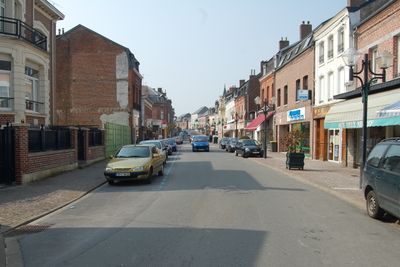
Fourmies is a town in northern France situated at an elevation of 202 meters (662 feet), with forests covering much of the surrounding area and the Helpe Mineure river flowing through the landscape. Ponds dot the terrain and contribute to the natural character of the place.

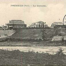
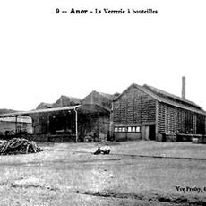
The first glass manufacturing works in northern France was established here in 1599, transforming the town into an industrial center. This early industry set the foundation for economic development that would shape the area for centuries to come.

The Grand Prix of Fourmies is an annual cycling race that has drawn professional riders and spectators to the town each year since 1928. This event shapes how locals and visitors see the place and brings people from across the region together.

The town connects well to larger cities through a railway line running between Lille and Hirson, making it relatively easy to reach by train. The Arc-en-Ciel bus network also provides connections to surrounding areas.

In May 1891, soldiers fired on striking workers here in what became a pivotal moment in French labor history and remains a significant chapter in the town's past. This event continues to be remembered as a turning point in the struggle for workers' rights.

The community of curious travelers

AroundUs brings together thousands of curated places, local tips, and hidden gems, enriched daily by 60,000 contributors worldwide.

Start exploring
Location
Elevation above the sea
216 m
Shares border with
Clairfontaine, Mondrepuis, Trélon, Wignehies, Anor, Féron, Glageon
Phone
GPS coordinates
50.01722,4.05333
Latest update
December 20, 2025 02:44
« Fourmies - Administrative center in Nord department, France » is provided by Around Us (aroundus.com). Images and texts are derived from Wikimedia project under a Creative Commons license. You are allowed to copy, distribute, and modify copies of this page, under the conditions set by the license, as long as this note is clearly visible.

Discover hidden gems everywhere you go!

From secret cafés to breathtaking viewpoints, skip the crowded tourist spots and find places that match your style. Our app makes it easy with voice search, smart filtering, route optimization, and insider tips from travelers worldwide. Download now for the complete mobile experience.

Around Us App Screenshot

A unique approach to discovering new places

Le Figaro

All the places worth exploring

France Info

A tailor-made excursion in just a few clicks

20 Minutes

Around Us
Travel Guide & Maps
Download

Send to your phone

QR Code
1

Open the camera app on your mobile.

2

Point at the QR code with your camera. A notification will appear.

3

Tap the notification to open the link.