Cap Gris Nez, Protected coastal cape in Pas-de-Calais, France
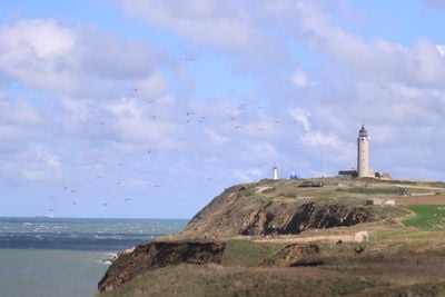
Cap Gris Nez is a protected coastal cape featuring grey sandstone cliffs that rise steeply above the English Channel. The location sits approximately 34 kilometers from the English coast, marking one of the closest points between France and England.
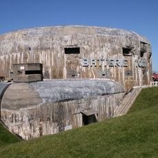
The site served as a key defensive position during World War II, where German forces built substantial fortifications as part of the Atlantic Wall defense system against the Allies. These structures remain visible features of the cape's landscape today.
The name derives from the Dutch "Gris Nez", meaning "grey nose", first recorded as "Swartenesse" to distinguish it from the "Blankenesse" (white cape) to the northeast. The element "-nesse" comes from the English "-ness", denoting a headland, as in Dungeness. The grey colour refers to the sandstone, clay and chalk cliffs.
The cape lies in Audinghen, about 15 km north of Boulogne-sur-Mer and 25 km southwest of Calais. The CROSS Gris-Nez rescue centre stands at the foot of the lighthouse, so the clifftop paths are shared with working installations. The cliffs reach 45 m and the ground is exposed; the crossing to Dover is only 30.3 km, and the English coast is visible in clear weather.
The cape marks the ecological boundary between the Channel and the North Sea: south of it, freshwater from coastal rivers feeds nurseries for young fish, a influence that fades further north. It is also a major migration bottleneck, and ornithologists gather here in spring and autumn.
The community of curious travelers
AroundUs brings together thousands of curated places, local tips, and hidden gems, enriched daily by 93,687 contributors worldwide.