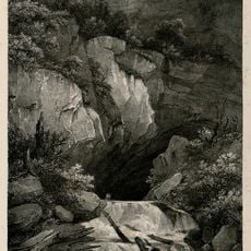
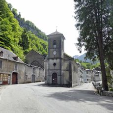
Chemin de la Mâture, Mountain trail in Urdos, France
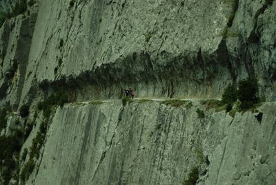
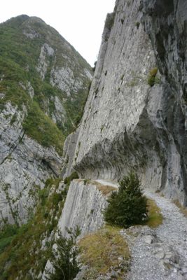
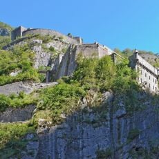
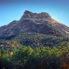
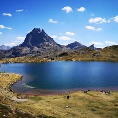
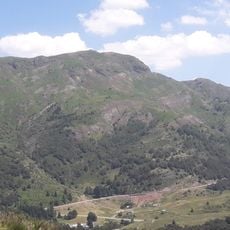
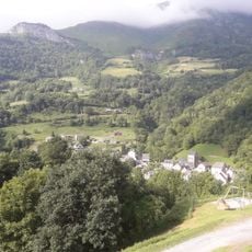
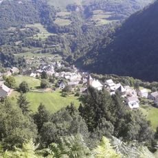
Chemin de la Mâture is a mountain trail in Urdos that runs along steep limestone cliffs high above the Gave d'Aspe river in the French Pyrenees. The route gains elevation through narrow passages carved directly into the rock face, offering hikers a close-up view of the valley's dramatic geology.
The trail was built in 1772 by engineer Paul-Marie Leroy to transport pine logs from Pacq forest for naval mast production. This construction served a practical military need during an era when France's maritime power depended on reliable timber supplies from mountain regions.
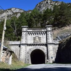
The path remains a vital link for hikers exploring the Pyrenees, drawing visitors who seek to experience the dramatic rock formations and steep terrain directly. The narrow route carved into the mountainside connects people to the landscape in a way that modern roads cannot replicate.
Sturdy hiking shoes with good grip are essential, as sections involve narrow passages and steep drops along the rock face. Visitors should avoid the route after rain or in poor visibility, and carry plenty of water and snacks for the full journey.
The path maintains its original width of approximately 1.2 meters, allowing modern hikers to walk the exact route used by timber workers centuries ago. This continuity creates an unexpected link between today's visitors and the daily work of people from the 1700s.
Location: Urdos
GPS coordinates: 42.88825,-0.56056
Latest update: December 6, 2025 16:04
The Nouvelle-Aquitaine region contains historic and natural sites often overlooked by traditional tourist routes. The area features military castles such as Bonaguil with its seven 13th-century towers, underground churches carved into limestone in Saint-Émilion and Aubeterre-sur-Dronne, as well as...
Pic du Midi d'Ossau
11.2 km
Fort du Portalet
275 m
Somport Rail Tunnel
10.7 km
Los Valles Occidentales Natural Park
12 km
Lac de Bious-Artigues
9.1 km
Castillo de Acher
11.4 km
Parc'Ours
2.3 km
Astún-Candanchú
11.4 km
Ludopia
10.7 km
Église Saint-Pierre de Cette
5.7 km
Lacs d'Ayous
7.7 km
Église Saint-Martin d'Accous
10.1 km
Église Saint-Michel de Borce
2.4 km
Église Sainte-Marie-Madeleine d'Urdos
1.8 km
Chapelle de Gabas
10.8 km
Chapelle d'Orcun
12.3 km
Chapelle Saint-Saturnin
11.2 km
Église Saint-Grat d'Etsaut
2.8 km
Église Saint-Barthélemy d'Eygun
5.7 km
Église Saint-Félix d'Athas
11.7 km
Église Notre-Dame de Lées
10.7 km
Grotte des Eaux Chaudes
11.3 km
Église de l'Assomption-de-la-Bienheureuse-Vierge-Marie d'Eaux-Chaudes
12.3 km
Pic d'Arnousse
8.7 km
Maison forte de Borce
2.4 km
Chapelle Saint-Jacques de Borce
2.7 km
Etsaut (munisipyo sa Pransiya)
2.8 km
Borce (munisipyo sa Pransiya)
2.5 kmVisited this place? Tap the stars to rate it and share your experience / photos with the community! Try now! You can cancel it anytime.
Discover hidden gems everywhere you go!
From secret cafés to breathtaking viewpoints, skip the crowded tourist spots and find places that match your style. Our app makes it easy with voice search, smart filtering, route optimization, and insider tips from travelers worldwide. Download now for the complete mobile experience.
A unique approach to discovering new places❞
— Le Figaro
All the places worth exploring❞
— France Info
A tailor-made excursion in just a few clicks❞
— 20 Minutes